High Route 1 — Stage 17: Rifugio Bonatti → Courmayeur
Advertencias
- Steep descent in the final forest section
- High tourist traffic in Courmayeur in August
 1 / 3
1 / 312.1 km
+300 m
−1101 m
3.5 h
Nivel físico
~2500 kcal estimadas
Mapa y ruta
Traza GPX oficial — Región Valle de Aosta / lovevda.it
Descripción
Puntos clave
Salida
Rifugio Walter Bonatti · 2023 m
Llegada
Courmayeur · 1200 m
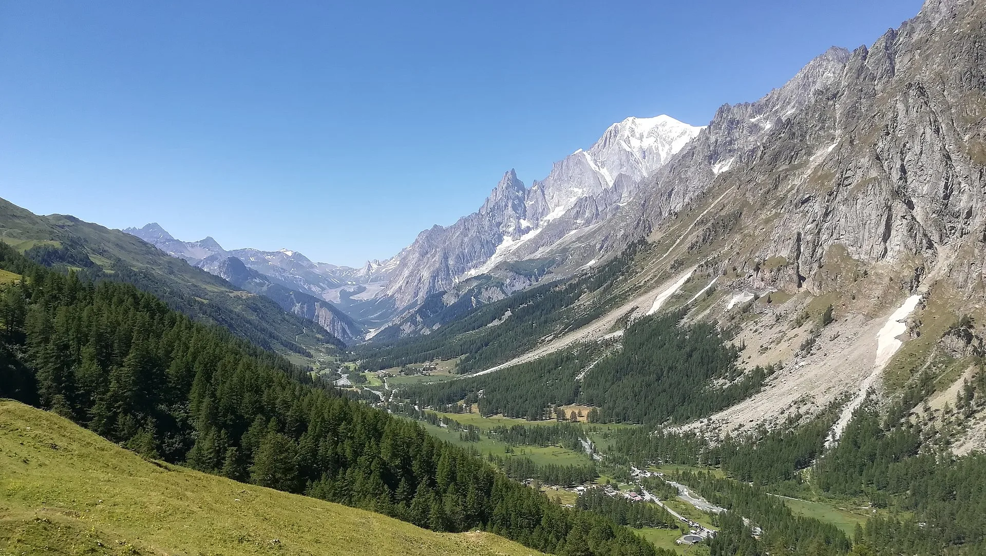
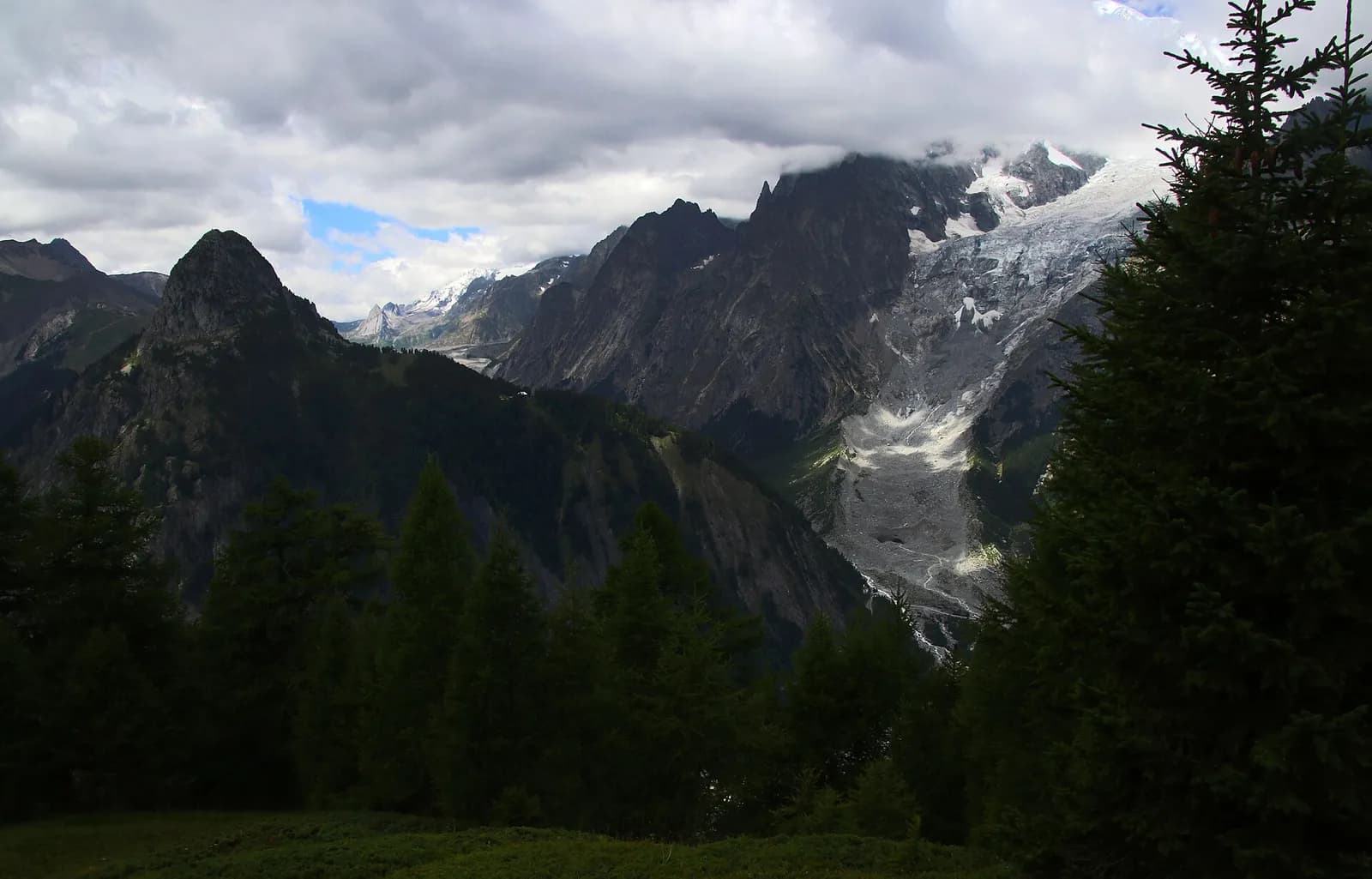
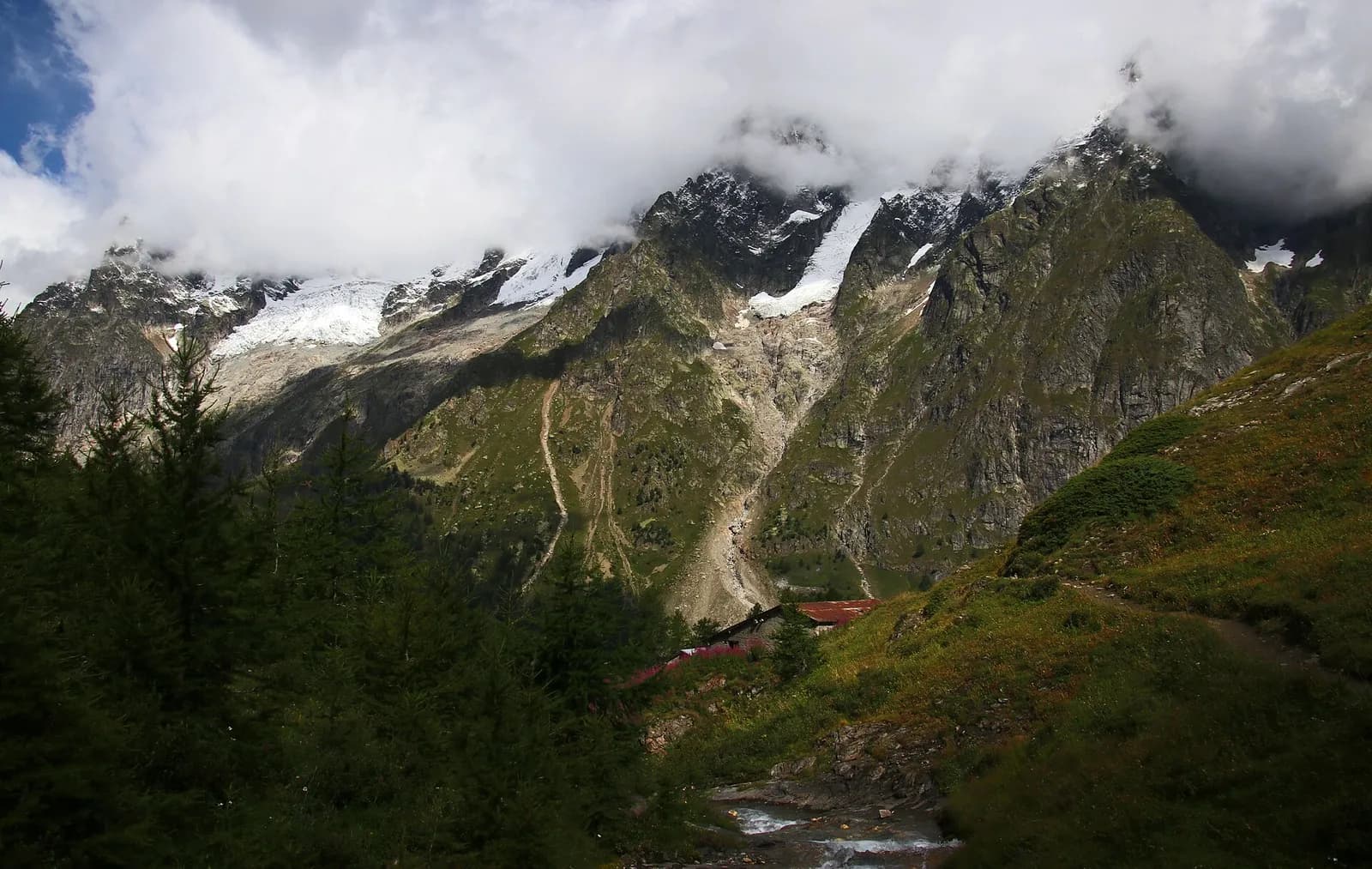
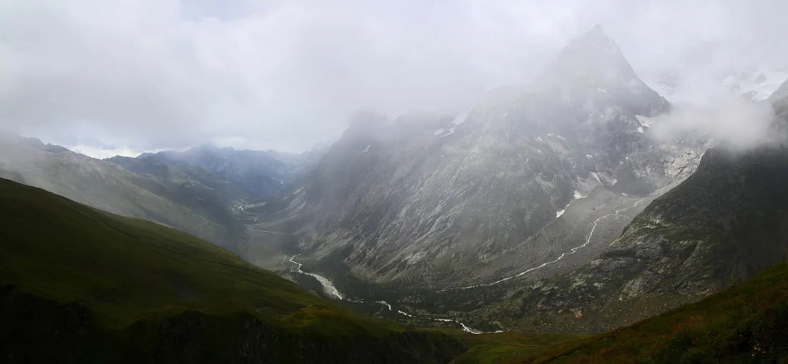
Stage seventeen, the final leg of Alta Via 1, is a long and celebratory descent to Courmayeur along the Val Ferret balcony trail, with Mont Blanc as a constant companion throughout. From Rifugio Bonatti the path crosses the valley head toward Rifugio Bertone (2048 m) along a trail following the forest edge with unbroken views onto Grandes Jorasses, Miage Glacier and the Mont Blanc crest. The final descent from Bertone to Courmayeur drops steeply through forest, emerging into town among the gardens of the historic centre. Courmayeur (1224 m) is one of Italy's alpine capitals, home to one of the country's oldest sections of the Club Alpino Italiano, an alpine museum dedicated to the history of early ascents and a vibrant main street lined with outdoor shops and restaurants serving fonduta. Completing this final stage after 17 stages and over 190 km of walking is a genuinely moving experience: many hikers mark the arrival with a toast on terraces overlooking the eternal white of the massif that accompanied every step of the journey.
Puntos clave
Rifugio Walter Bonatti
2025 m · 0 km from start
Stage start, last AV1 night
Rifugio Bertone
2048 m · 6.5 km from start
Intermediate hut with panoramic terrace
Courmayeur
1224 m · 12.1 km from start
AV1 finish, alpine capital
Ciencias de la Tierra
Geología y paisaje
The descent along Val Ferret crosses gneiss and calcschists of the Mont Blanc massif with deformed granite and mica phyllite outcrops. The balcony trail follows a Würmian moraine front of the Miage glacier with proglacial deposits and abandoned terraces. Below 1800 m, alluvial deposits of the Ferret stream appear with pebbles of gneiss, granite and limestone. Forested slopes display paleosols on decomposed moraines with acid soils suited to larch and rhododendron. The Miage glacier, visible from the trail, is among the most monitored in the Alps for glaciological retreat. Marble and calcschist outcrops indicate the massif sedimentary cover.
Historia y cultura
Courmayeur is an alpine capital with a historic CAI section and alpine museum. Completing the AV1 after 17 stages and over 190 km is celebrated on the centre terraces.
Fuentes de agua
Water at Bonatti and Bertone huts. Fountains in Courmayeur centre.
Cómo llegar
VITA and Savda buses to Courmayeur from Aosta. Summer Val Ferret connections.
Aparcamiento
Parcheggi a Courmayeur centro e La Palud (funivia Monte Bianco).
Cumbres cercanas
Refugios y vivacs
Galería de fotos
Photos are published immediately. JPG/PNG/WebP, max 6 MB.
Flora del sendero
Fauna que observar
Temas y características
Etapas contiguas
AEditado y verificado por Andrea Rama
Fuente de datos: Catasto Sentieri Regione VdA + AllTrails (12.1 km verificati) · Open data — DGR 899/2014
Última verificación:
Val Ferret
Senderos relacionados
Mismo valle o rutas similares — más excursiones por descubrir.
Val Ferret
Tour du Mont Blanc — Stage 1: Courmayeur → Rifugio Giorgio Bertone
A steady climb from Courmayeur to the Rifugio Bertone balcony.
Val Ferret
Tour du Mont Blanc — Stage 2: Rifugio Giorgio Bertone → Rifugio Walter Bonatti
The Mont de la Saxe balcony, face to face with the Grandes Jorasses.
Val Ferret
Tour du Mont Blanc — Stage 3: Rifugio Walter Bonatti → Rifugio Elena
Towards the head of Val Ferret, below the Pré de Bar glacier.
Val Ferret — Val Ferret svizzera
Tour du Mont Blanc — Stage 4: Rifugio Elena → La Fouly
The Grand Col Ferret: leaving Italy, entering Switzerland.