High Route 1 — Stage 16: Rifugio Frassati → Rifugio Bonatti via Col Malatrà
Advertencias
- AV1 highest point: check weather and snow
- Long descent on dew-wet grass in the morning
- Book Bonatti weeks in advance
 1 / 3
1 / 310 km
+430 m
−900 m
4 h
Nivel físico
~3100 kcal estimadas
Mapa y ruta
Traza GPX oficial — Región Valle de Aosta / lovevda.it
Descripción
Puntos clave
Salida
Rifugio Pier Giorgio Frassati · 2506 m
Llegada
Rifugio Walter Bonatti · 2023 m
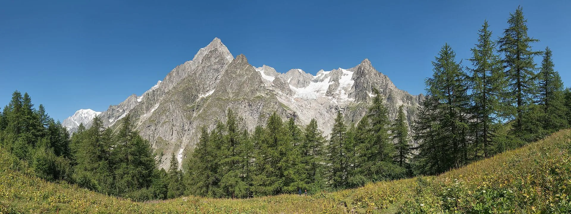
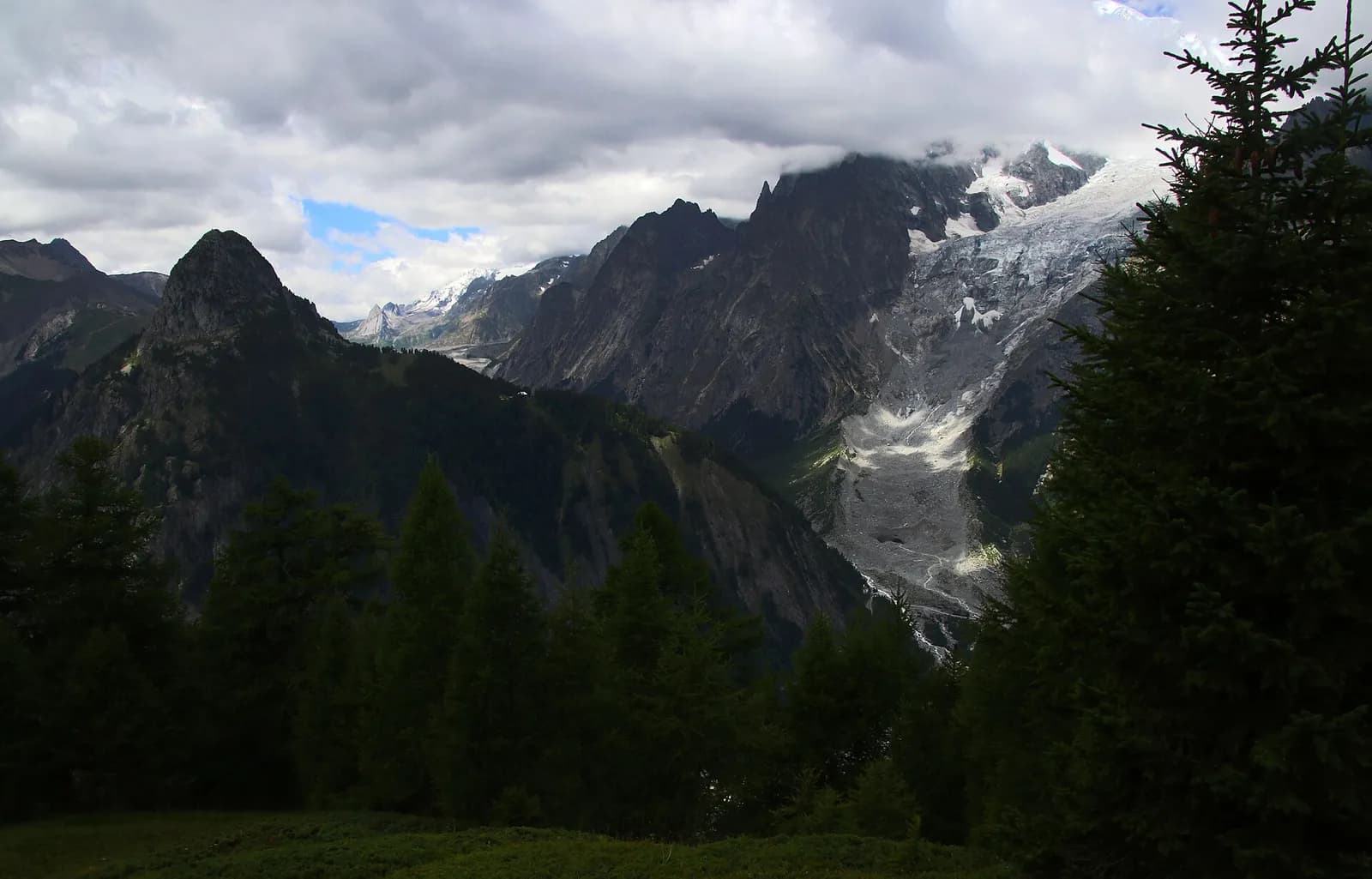
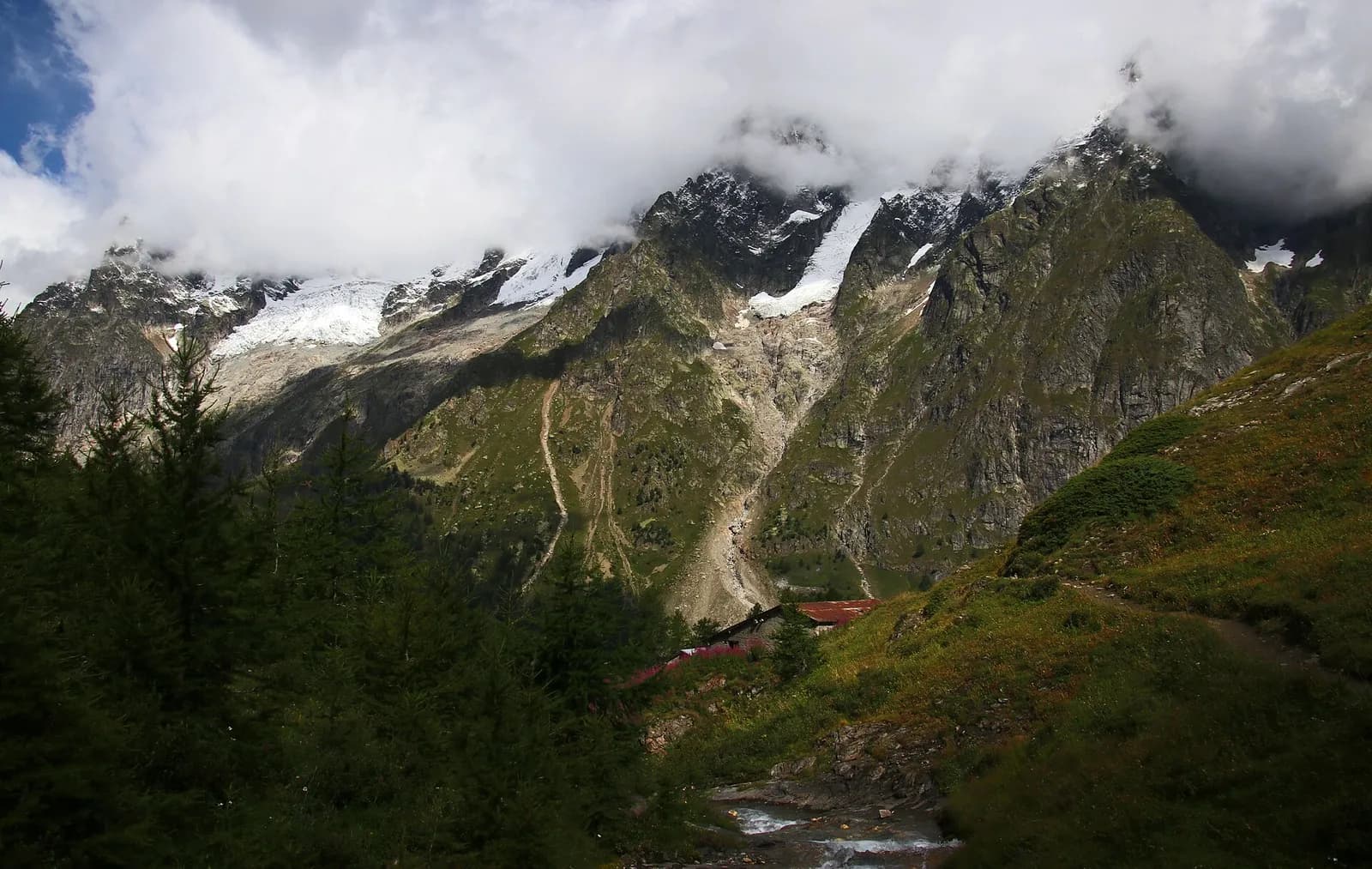
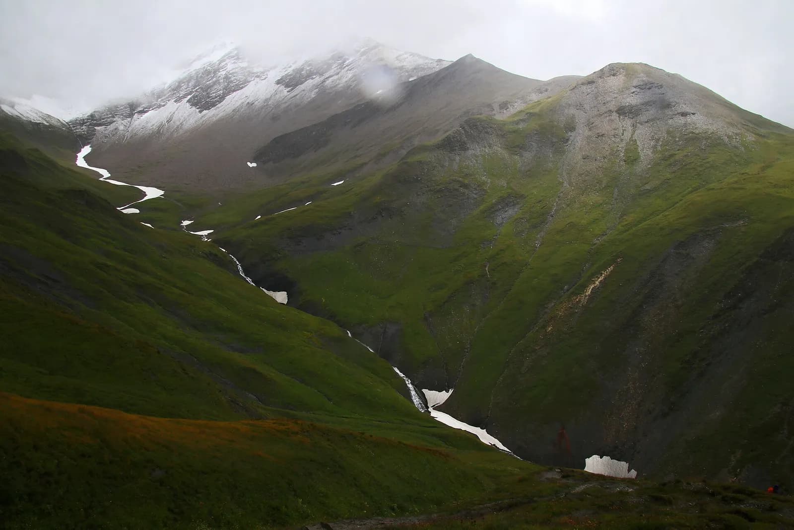
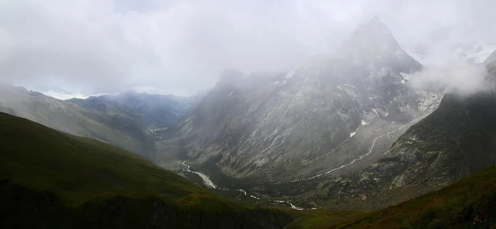
Stage sixteen is the most alpine stretch of the entire Alta Via 1: it climbs to Col Malatrà at 2925 metres — the highest point of the whole route — and descends into Val Ferret to Rifugio Walter Bonatti. From Rifugio Frassati the path rises through the Merdeux basin on progressively rockier and more open terrain, with sections of compact scree demanding careful footwork. The cross at Col Malatrà is a long-awaited landmark: at this altitude the panorama is absolute, with Mont Blanc rising in full majesty to the northwest, Grand Combin to the east and the Gran Paradiso summits on the distant horizon. The descent toward Val Ferret is long and occasionally slippery — dew-wet grass early in the morning — so staying on the marked trail is essential. Rifugio Walter Bonatti (2025 m) is the most celebrated overnight stop on the entire Alta Via 1, made famous through its proximity to the Tour du Mont Blanc, offering an unrivalled view of Mont Blanc. Reservations weeks in advance are indispensable during peak season.
Puntos clave
Rifugio Pier Giorgio Frassati
2540 m · 0 km from start
Stage start, leave at dawn
Col Malatrà
2925 m · 5.5 km from start
Highest point on entire AV1, panoramic cross
Ciencias de la Tierra
Geología y paisaje
Col Malatrà is the geological rooftop of the AV1, on augen gneiss and micaschists of the Austroalpine basement with quartz bands and migmatites. The ascent crosses Penninic calcschists and chloritic phyllites with deformed granite outcrops. The descent into Val Ferret traverses Würmian glacial deposits of the Miage glacier with lateral moraines and proglacial sediments. Erratic blocks of gneiss and granite testify to glacial transport. Malatrà valley slopes show active landslides and periglacial scree deposits. Below 2200 m, dolomitic limestone and schist outcrops of the lower Penninic stack appear with ophiolites in side valleys.
Historia y cultura
Rifugio Walter Bonatti is dedicated to the great Italian explorer. Val Ferret is a historic valley of the Tour du Mont Blanc and early alpine ascents.
Fuentes de agua
Water at Rifugio Frassati. Carry supplies for the pass climb. Water at Rifugio Bonatti.
Cómo llegar
Foot access only. Emergency descent via Val Ferret or Petit Saint-Bernard.
Cumbres cercanas
Refugios y vivacs
Galería de fotos
Photos are published immediately. JPG/PNG/WebP, max 6 MB.
Flora del sendero
Fauna que observar
Temas y características
Etapas contiguas
AEditado y verificado por Andrea Rama
Fuente de datos: Catasto Sentieri Regione VdA + thealps.com — km stimati, D+/D− da GPS traces · Open data — DGR 899/2014
Última verificación:
Val Ferret
Senderos relacionados
Mismo valle o rutas similares — más excursiones por descubrir.
Val Ferret
Tour du Mont Blanc — Stage 1: Courmayeur → Rifugio Giorgio Bertone
A steady climb from Courmayeur to the Rifugio Bertone balcony.
Val Ferret
Tour du Mont Blanc — Stage 2: Rifugio Giorgio Bertone → Rifugio Walter Bonatti
The Mont de la Saxe balcony, face to face with the Grandes Jorasses.
Val Ferret
Tour du Mont Blanc — Stage 3: Rifugio Walter Bonatti → Rifugio Elena
Towards the head of Val Ferret, below the Pré de Bar glacier.
Val Ferret — Val Ferret svizzera
Tour du Mont Blanc — Stage 4: Rifugio Elena → La Fouly
The Grand Col Ferret: leaving Italy, entering Switzerland.