High Route 1 — Stage 4: Rifugio Barma → Niel
Avisos
- Sustained descent: protect your knees
- Slippery trail on wet leaves in autumn
 1 / 2
1 / 210 km
+180 m
−980 m
4 h
Nível físico
~2300 kcal estimadas
Mapa e percurso
Traço GPX oficial — Região Vale de Aosta / lovevda.it
Descrição
Pontos-chave
Partida
Rifugio Barma · 2054 m
Chegada
Niel · 1552 m
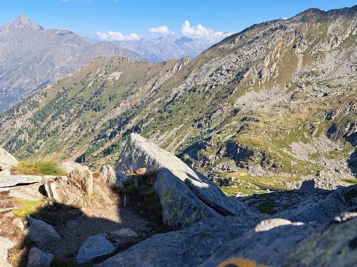
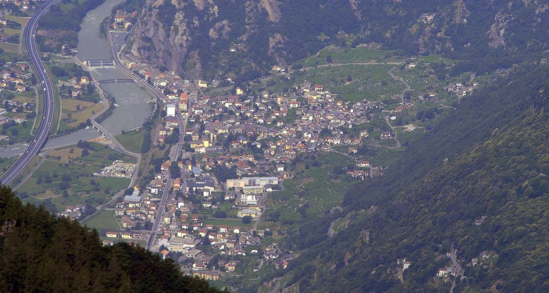
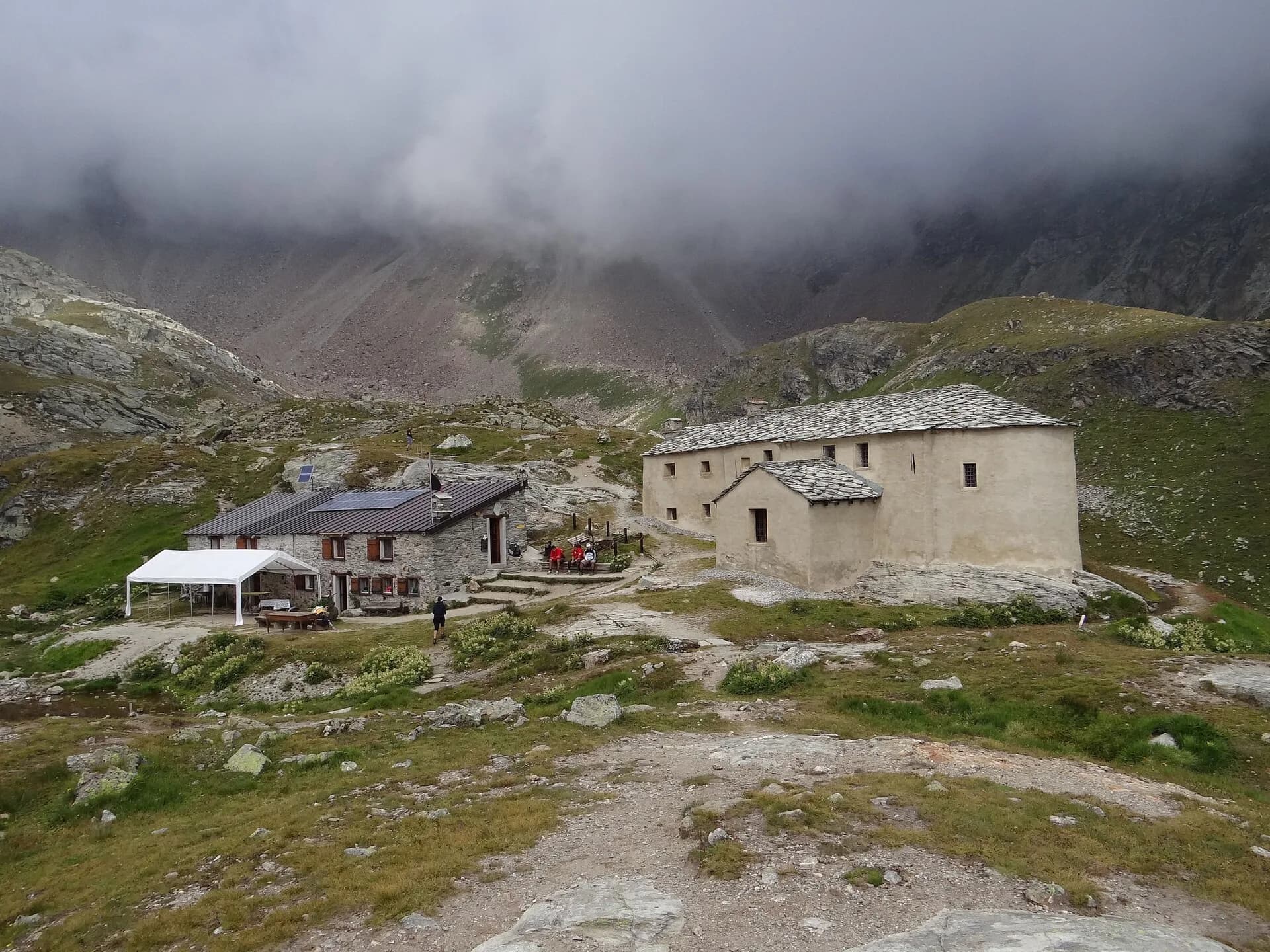
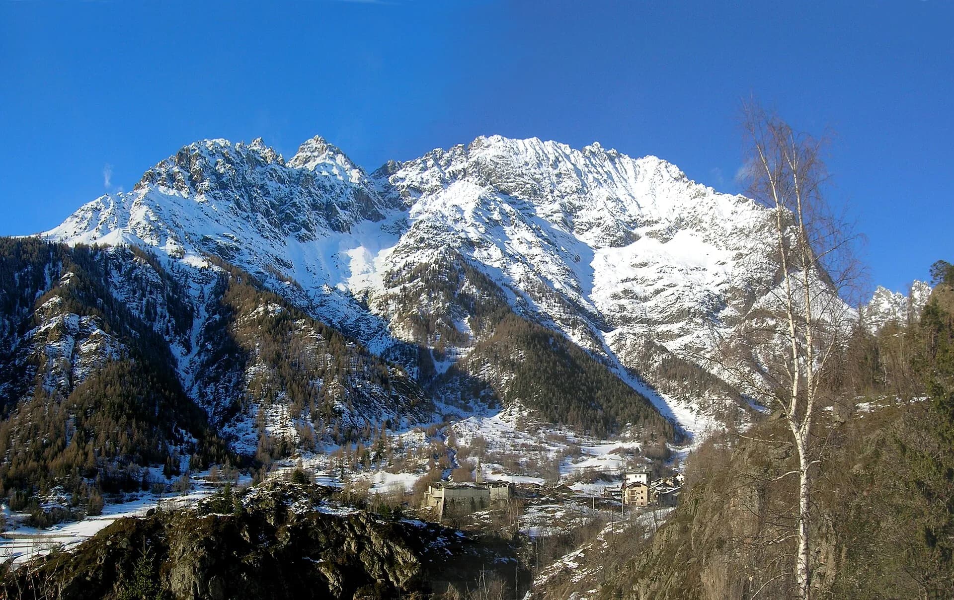
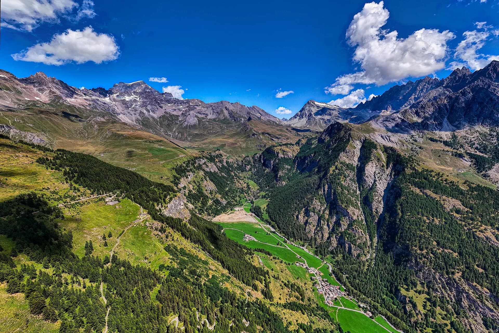
From the Barma Lakes basin, stage four begins with a brief high-altitude stretch before committing to a long descent toward Niel, a Walser hamlet in the municipality of Gaby. The path crosses Col della Vecchia — a smooth rocky ridge marked by a small stone pyramid indicating the border with Piedmont — then drops into a sparse conifer forest where the gradient steepens and the sound of a lateral stream escorts walkers downhill. Niel is a hidden gem: a handful of stone and larch Walser houses, some dating back centuries, clinging to the slope above the Gaby valley floor. La Gruba Relais, the stage's official endpoint, is a small hotel converted from a restored barn offering the most authentic rural hospitality on the entire route. From Gaby a regional bus descends to the main valley, providing an exit option for those who need to interrupt the Alta Via. The stage is short relative to others, but sustained descent demands well-gripping footwear and mindful attention to the knees.
Pontos-chave
Rifugio Barma
2191 m · 0 km from start
Stage start
Col della Vecchia
2280 m · 4.5 km from start
High point, stone pyramid on the Piedmont border
Ciências da Terra
Geologia e paisagem
The descent from Barma crosses the eastern slope of Mont Mars, with micaschists and augen gneiss of the Austroalpine basement outcropping along Col della Vecchia. Below 1800 m the substrate is masked by colluvial deposits and Würmian moraines with erratic blocks of gneiss and quartzite. The forested slope toward Niel shows paleosols on decomposed micaschists and fluvial terraces of the Gaby stream. The stone pyramid at Col della Vecchia marks a geological and administrative boundary between Aosta Valley and Piedmont. Eluvial deposits rich in mica and quartz indicate intense chemical weathering on south-facing slopes. Mesozoic limestones of the lower Penninic stack outcrop only in the Gaby valley floor.
História e cultura
Niel is one of the most remote Walser settlements in the Gaby valley, with medieval stone and larch houses. La Gruba Relais, a restored barn, symbolises Valdostan rural hospitality.
Pontos de água
Water at Rifugio Barma. Springs in the forest below Col della Vecchia. Bar and fountain at Niel/La Gruba.
Como chegar
VITA bus from Gaby to the valley floor and Pont-Saint-Martin. From Niel, limited connections toward Gressoney.
Estacionamento
Parcheggio a Gaby centro; accesso a Niel solo a piedi o taxi locale su prenotazione.
Cumes próximos
Refúgios e abrigos
Galeria de fotos
Photos are published immediately. JPG/PNG/WebP, max 6 MB.
Flora do trilho
Fauna para observar
Temas e características
Etapas adjacentes
AEditado e verificado por Andrea Rama
Fonte dos dados: Catasto Sentieri Regione VdA + gressoneymonterosa.it (km stimati, non verificati da 2 fonti indipendenti) · Open data — DGR 899/2014
Última verificação:
Valle di Gaby
Trilhos relacionados
Mesmo vale ou percursos semelhantes — mais caminhadas para descobrir.
Bassa Valle
High Route 1 — Stage 1: Donnas → Perloz
The start of the High Route of the Giants, from the valley floor up to Perloz meadows through Walser villages and chestnut groves.
Valtournenche — Val Saint-Barthélemy
High Route 1 — Stage 10: Rifugio Jean Barmasse → Rifugio Oratorio di Cuney
The wild heart of the Alta Via: 17 km across Fenêtre de Tsan, Col Terray and on to Rifugio Oratorio di Cuney, with Matterhorn and Grand Combin dominating a horizon of 2700-metre passes.
Valpelline
High Route 1 — Stage 11: Rifugio Oratorio di Cuney → Oyace
From the Sanctuary of Cuney to the Valpelline: a long descent over exposed ridges with short scramble sections, ending at Oyace in the heart of the Aosta Valley's most untouched valley.
Valpelline
High Route 1 — Stage 12: Oyace → Ollomont via Col Brison
The wild Valpelline: Oyace and Ollomont sit at nearly the same elevation, but Col Brison at 2520 m demands over 1100 m of climbing with views to Mont Vélan and Grand Combin on the Swiss border.