High Route 1 — Stage 7: Rifugio Vieux Crest → Rifugio Grand Tournalin
Avisos
- Scree sections require careful footing
- Book Rifugio Grand Tournalin in peak season
 1 / 4
1 / 411.6 km
+1162 m
−1044 m
5.5 h
Nível físico
~3400 kcal estimadas
Mapa e percurso
Traço GPX oficial — Região Vale de Aosta / lovevda.it
Descrição
Pontos-chave
Partida
Rifugio Vieux Crest · 1925 m
Chegada
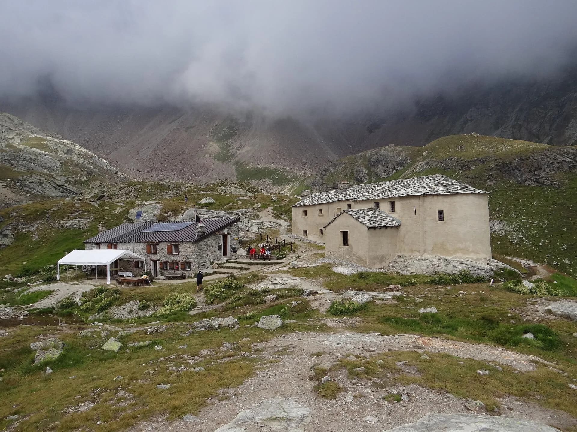
Rifugio Grand Tournalin · 2543 m
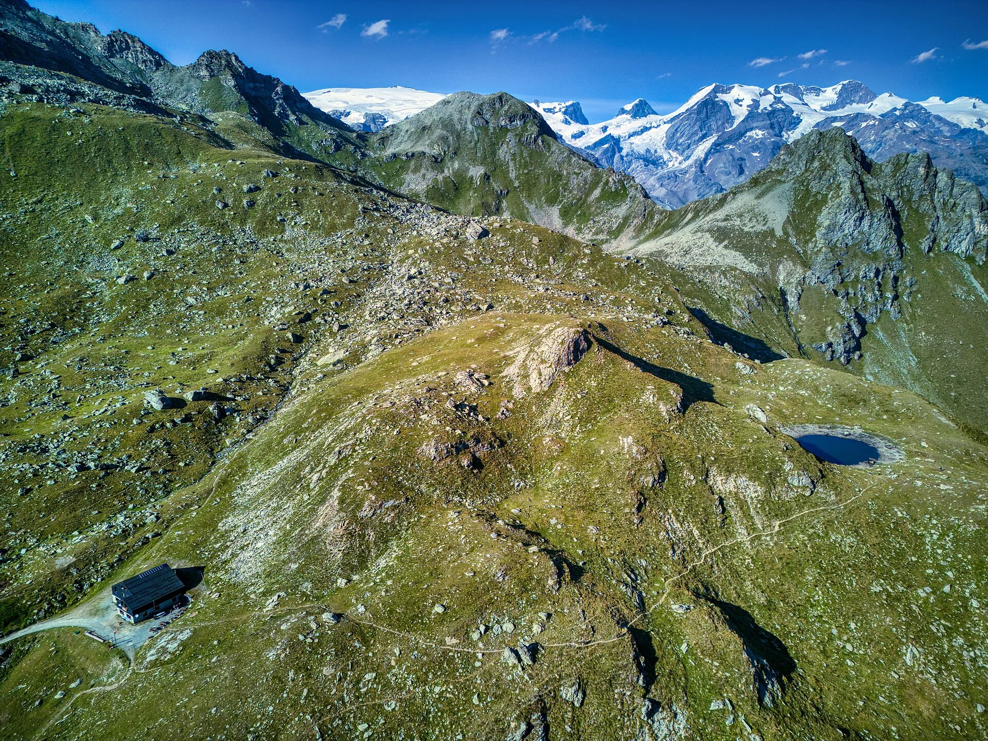
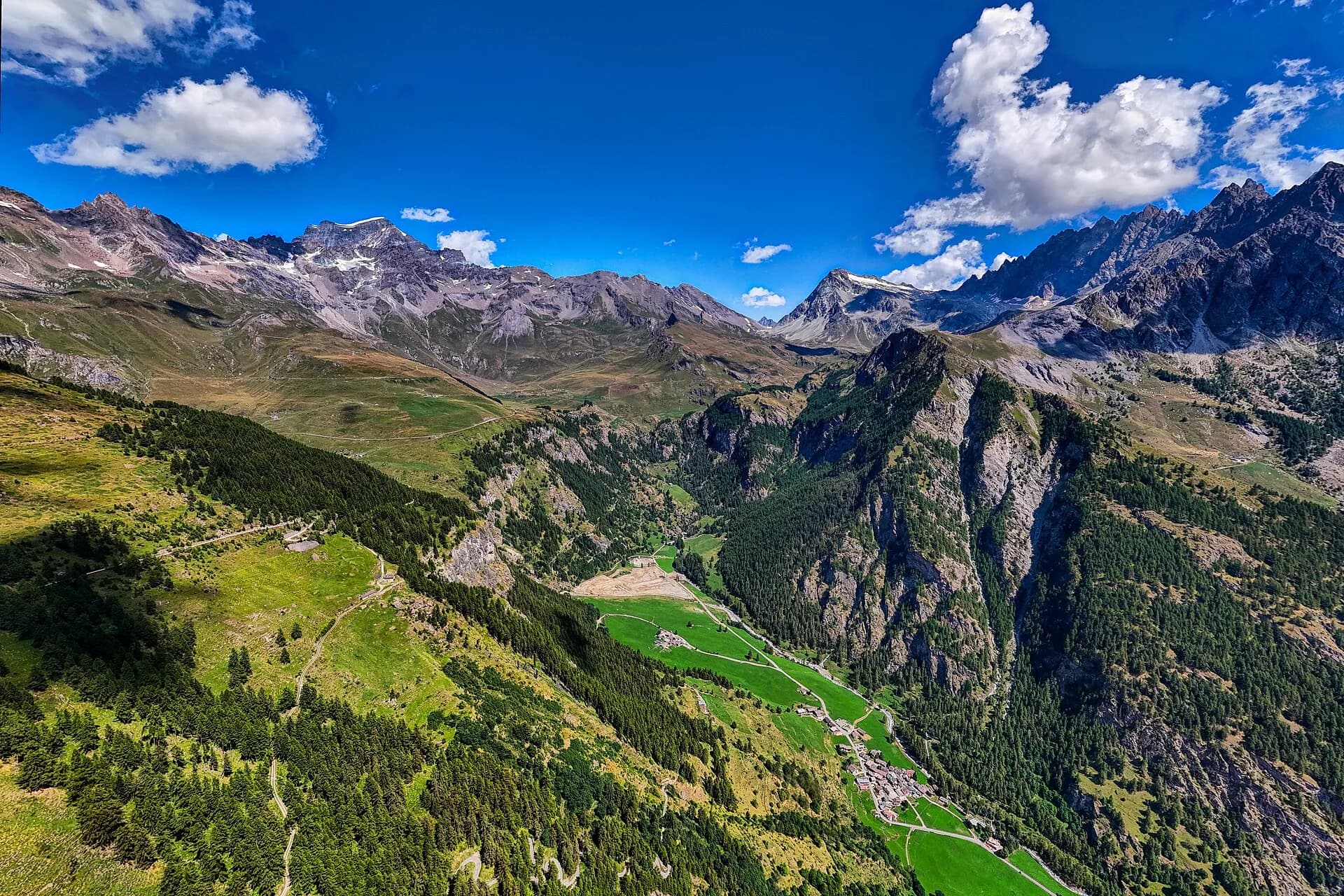
Stage seven is one of the most varied on the entire Alta Via 1: leaving Rifugio Vieux Crest, the trail descends into the Résy valley before climbing steadily across the ridges above Champoluc, with the Matterhorn's profile sharpening on the horizon as altitude increases. The Ayas valley unfolds across a landscape of high-altitude summer farms where dry-stone buildings — barns, stalls, tabià shelters — bear witness to a centuries-old pastoral economy that remains active today. The path crosses high pastures where Valdostana cattle graze freely through summer, skirts the hamlet of Frachey and climbs toward Col Roisetta (2679 m), one of the widest viewpoints of the stage. The final descent and reascent lead to Rifugio Grand Tournalin (2535 m), a classic AV1 overnight stop with a terrace offering direct views of the Matterhorn. The EE rating reflects sustained elevation gain and scree sections demanding careful footwork rather than any technical passage. The hut provides half-board accommodation: reservations are strongly advised in July and August when AV1 hiker traffic peaks.
Pontos-chave
Rifugio Vieux Crest
2417 m · 0 km from start
Stage start
Ciências da Terra
Geologia e paisagem
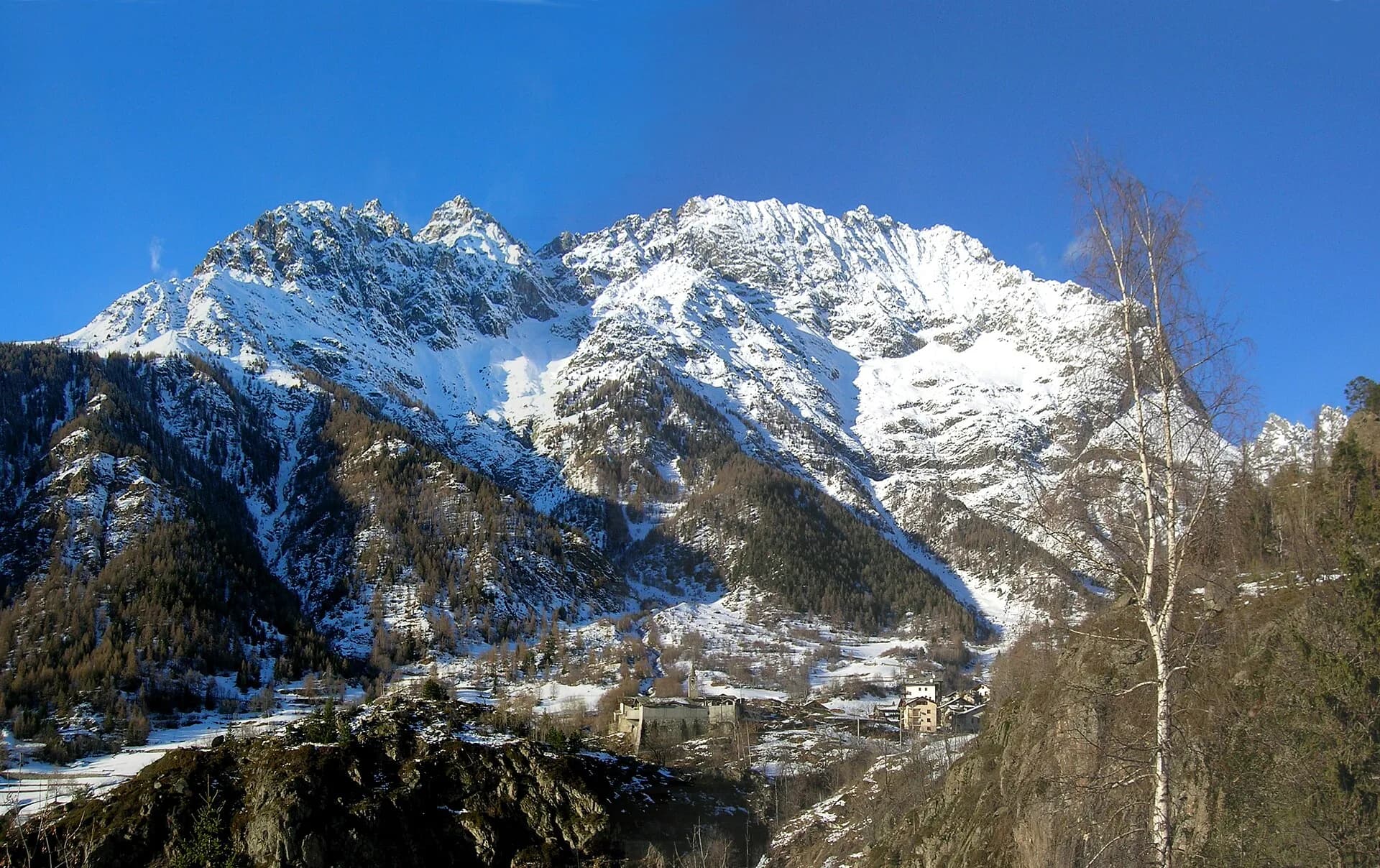
The stage crosses the Austroalpine domain of Ayas valley with micaschists, augen gneiss and mica phyllites along ridges above Champoluc. Col Roisetta displays metamorphic rocks with quartz and garnet bands, evidence of Barrovian metamorphism. Frachey pastures develop on Würmian glacial deposits with rebuilt moraines and post-glacial aeolian deposits. Toward Tournalin, quartzites and weakly foliated gneiss appear with pegmatite outcrops. The eastern Matterhorn slope consists of Penninic gneiss and calcschists with ophiolites in Valtournenche valley. Colluvial deposits and active gullies indicate slope instability below 2400 m.
História e cultura
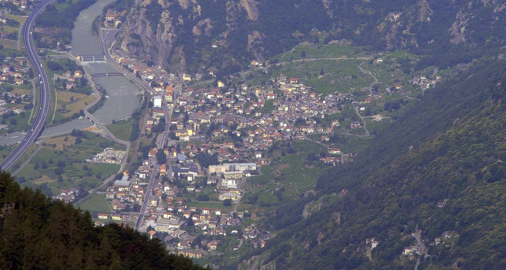
Dry-stone buildings (tabià, barns) of Ayas valley testify to an active pastoral economy. Frachey is the departure point for the Matterhorn cable car.
Pontos de água
Water at Rifugio Vieux Crest and Grand Tournalin. Sources near Frachey in summer.
Como chegar
Champoluc–Crest cable car for alternative access. VITA bus to Champoluc from Verrès/Aosta.
Estacionamento
Parcheggi a Champoluc e St-Jacques; tappa point-to-point tra rifugi.
Cumes próximos
Refúgios e abrigos
Galeria de fotos
Photos are published immediately. JPG/PNG/WebP, max 6 MB.
Flora do trilho
Temas e características
Etapas adjacentes
AEditado e verificado por Andrea Rama
Fonte dos dados: Catasto Sentieri Regione VdA + AllTrails (11.6 km, +1162 m verificati) · Open data — DGR 899/2014
Última verificação:
Valle d'Ayas
Trilhos relacionados
Mesmo vale ou percursos semelhantes — mais caminhadas para descobrir.
Bassa Valle
High Route 1 — Stage 1: Donnas → Perloz
The start of the High Route of the Giants, from the valley floor up to Perloz meadows through Walser villages and chestnut groves.
Valtournenche — Val Saint-Barthélemy
High Route 1 — Stage 10: Rifugio Jean Barmasse → Rifugio Oratorio di Cuney
The wild heart of the Alta Via: 17 km across Fenêtre de Tsan, Col Terray and on to Rifugio Oratorio di Cuney, with Matterhorn and Grand Combin dominating a horizon of 2700-metre passes.
Valpelline
High Route 1 — Stage 11: Rifugio Oratorio di Cuney → Oyace
From the Sanctuary of Cuney to the Valpelline: a long descent over exposed ridges with short scramble sections, ending at Oyace in the heart of the Aosta Valley's most untouched valley.
Valpelline
High Route 1 — Stage 12: Oyace → Ollomont via Col Brison
The wild Valpelline: Oyace and Ollomont sit at nearly the same elevation, but Col Brison at 2520 m demands over 1100 m of climbing with views to Mont Vélan and Grand Combin on the Swiss border.