Trail guide
The 5 most panoramic trails in Aosta Valley
Five hikes with 360° views in Aosta Valley — Mont Blanc, Petit St Bernard, High Routes and Gran Paradiso.
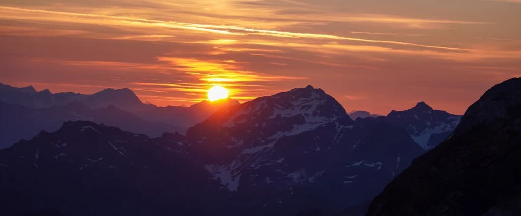
When a hiker asks "which is the most panoramic trail in the Aosta Valley?", the honest answer is: it depends on what you want to see. Glacial walls that fill the horizon? Chains of four-thousand-metre peaks? Deep valleys carved by ice? State borders on suspended ridges? The region offers all of this, often in a single day's walk, yet no single trail monopolises the idea of "panorama". We have selected five routes with broad, continuous horizons — none repeats the lakes or the classics already mentioned in the site's other guides — where the view isn't a final reward after hours of effort, but the common thread of the entire walk.
Panorama doesn't mean "easy". Even the most scenic trails can be E or EE. Read the trail pages for elevation gain, exposure and equipment.
Why the panorama matters — and how to read it
In the mountains, the panorama is geology made visible. "U"-shaped valleys are glacial; "V"-shaped ones are fluvial. The ridges you follow are often lines of tectonic boundary; the glaciers you see in the distance are indicators of the alpine climate. Walking an Aosta Valley panoramic trail means crossing tens of millions of years of Earth's history — with your legs and, if you're lucky, with a sky that cooperates.
The tradition of "panoramic mountaineering" — walking not to conquer a summit but to see — was born precisely in these valleys. Vittorio Sella photographed the glaciers of the Gran Paradiso; Walter Bonatti wrote of the Val Ferret as a "natural cathedral". The five trails below are heirs to that tradition: they require neither rope nor ice axe, but they do require open eyes and time to devote to pauses. A panorama consumed on the run leaves no memory; one savoured sitting on a stone, with the sun sliding across the rock face, does.
1. Courmayeur–Rifugio Bertone — Mont Blanc opens up entirely
The first stage of the Tour du Mont Blanc is the "school of panorama" for those visiting Courmayeur for the first time. From Courmayeur — a village of Roman origins transformed into the capital of Italian mountaineering — the trail climbs through chestnut and larch woods, then meadows that gradually open onto the Mont Blanc massif. There is no single "wow" point: the horizon widens at every switchback, until it fills the field of vision with glaciers, walls and peaks exceeding four thousand metres.
The difficulty is E, with sustained elevation gain but no technical sections. The Rifugio Bertone, at 1995 metres, is a perfect destination for a lunch with a view or for an overnight stay before continuing towards the Bonatti. A practical tip: leave Courmayeur with the Val Veny cable car if you want to shorten the route, but the full climb repays every kilometre with perspectives the cable car doesn't offer.
Mont Blanc, seen from the Italian side, reveals the profile of the Miage, the Grandes Jorasses, the Dente del Gigante. It's the panorama that inspired Walter Bonatti, Cesare Maestri and generations of mountaineers. Walking towards the Bertone means entering that tradition without rope and ice axe: just boots, a steady pace, and eyes that are never enough.
Halfway up the climb, when the woods give way to meadows, stop and look back: Courmayeur shrinks to a smudge of rooftops, the Val Veny opens to the west, and the contrast between the green of the valley floor and the white of the peaks becomes a geography lesson. Bring a polarising filter if you photograph: the alpine sky, in the central hours, has a blue that only high altitude can produce.
2. Rifugio Elena–Col de la Seigne — border and glaciers
Stage 4 of the TMB, Elena–Col Seigne offers one of the most scenic border passes in the western Alps. From the Rifugio Elena you climb towards the Col de la Seigne, at 2516 metres, where the Italian side gives way to the French side and the panorama embraces the basin of Chamonix, the Miage glacier and the ridges that separate the two valleys.
The difficulty is E, with stretches exposed to the wind. Bring sunglasses, a windbreaker and warm layers: at the col, even in July, the temperature can drop ten degrees compared to the valley floor. The wind is part of the spectacle — and part of the risk: check the weather and don't push on if low clouds would erase the view and your bearings.
The Col Seigne is a historic pass for commercial transit and pilgrimage. Today thousands of Tour du Mont Blanc hikers cross it every summer. Once at the top, allow yourself at least half an hour: the panorama to the west — Mont Blanc, Aiguilles Rouges, the Chamonix valley — is different from any point on the Italian side. Bring your passport: you are on the border, even if there is no customs post for pedestrians.
3. Alta Via 1, Coda–Barma stage — balcony over Monte Rosa
Stage 3 of the AV1 crosses the Gressoney slope with continuous views over the peaks of Monte Rosa — Punta Dufour, Lyskamm, Castor, Pollux — and over the Walser valleys descending towards the Dora Baltea. It's a "slow" panorama, to be savoured while walking: there's no single dramatic moment, but hours of horizon that change with the light and with the passage of the clouds.
The difficulty is E, with elevation gain distributed over a whole day. The Rifugio Coda and the Rifugio Barma — or Rifugio Oreste Huppé, depending on the variant — are classic stages of the Alta Via 1, which can also be walked by hikers who do not complete the entire traverse. Gressoney Saint-Jean, an alternative starting point, offers connections and services.
The Walser culture of Gressoney adds a "human" dimension to the panorama: wooden houses, ancient German place names, polenta concia in the refuges. You walk among alpine meadows where livestock still grazes as it did five centuries ago. Monte Rosa, seen from the south, shows the "Italian" side of the massif: glaciers, walls of pink granite, suspended valleys that seem drawn by a Renaissance cartographer.
4. Alta Via 2, Courmayeur–Elisabetta stage — Val Veny from above
The first stage of the AV2 climbs to the Rifugio Elisabetta with the profile of Mont Blanc revealing itself at every switchback. While stage 1 of the TMB (Bertone) follows the opposite side of the Val Ferret, the AV2 runs through the Val Veny — a "noble" valley, less crowded, equally scenic — with different perspectives on the massif and on the Brenva glacier.
The difficulty is E. The Rifugio Elisabetta Soldini Montanaro, dedicated to the memory of a pioneer of women's mountaineering, stands in a commanding position over the valley. Spending the night here means dawn over Mont Blanc without getting up at dawn: open your eyes and the wall is right there. A smart choice for a Saturday in July when the Bertone and the Bonatti are booked months in advance.
The Alta Via 2, from its first stage, announces the character of the entire traverse: wild valleys, welcoming refuges, difficulties generally higher than the AV1. Courmayeur–Elisabetta is the gateway: if you enjoy it, plan the following stages towards the Chalet de l'Épée and beyond. If you prefer to head back, the descent to Courmayeur in a day is feasible for fit hikers.
5. Eaux Rousses–Rifugio Vittorio Sella — the heart of the Gran Paradiso
Stage 4 of the Tour Gran Paradiso crosses glacial valleys with ibex, moraines and granite walls in Italy's oldest national park. The panorama here is "Nordic": broad valleys, a sky that seems closer, grey and green rocks contrasting with the permanent snow on the peaks. The Rifugio Vittorio Sella — dedicated to the great photographer and mountaineer who documented the world's glaciers — is both destination and symbol.
The difficulty is E, with the possibility of snow on the minor passes until mid-July. The park's wildlife — ibex, chamois, marmots — is accustomed to the human presence but must be respected at a distance. Bring binoculars: observing a herd of ibex on the moraines with the Gran Paradiso in the background is an experience that no panorama of bare rock can equal.
Eaux Rousses, a starting or passing point, is a hamlet of few inhabitants in the Rhêmes valley: silence, stone houses, the sound of the streams. The stage towards the Sella crosses landscapes that the photographer of the same name would have loved. Once at the refuge, the view towards the glacial valleys and the peaks beyond three thousand metres repays every hour of climbing. Book ahead: the Sella is among the most sought-after refuges in the park.
Compare, if you can, a historic photo of the valley with what you see today: the glaciers have retreated, the moraines have stabilised, the vegetation is rising. The Gran Paradiso panorama is also a climate document. Walking here with children — if you have them — means conveying that message without preaching: just point to where the snow "used to" reach and let them ask questions.
When to go
| Trail | Best light | Season |
|---|---|---|
| Bertone / Elisabetta | Sunset over the Miage | June–September |
| Col Seigne | Morning (fewer clouds) | July–August |
| AV1 stage 3 | Midday (Monte Rosa) | July–September |
| Vittorio Sella | First light in the valley | June–September |
Why five — and not ten
A "three-hundred-and-sixty-degree" panorama does not exist in nature: there is always a privileged direction, a moment of light, an atmospheric condition that enhances or erases the view. These five trails cover four massifs and three types of horizon — Mont Blanc, Monte Rosa, Gran Paradiso — without repeating the same valleys. If you've walked one, the others will show you complementary angles.
"Panorama only, little effort" variant
If you're after the maximum view-to-effort ratio, shorten the climb to the Bertone by stopping at Monte de la Saxe — an intermediate point with an already complete panorama — and head back to Courmayeur without reaching the refuge. Use TMB stage 1 as a reference for the route. For a full day with a guaranteed panorama, none of the five disappoints — provided you choose a day with stable weather and visibility over ten kilometres.
Photo credits
Cover: Unsplash — Panorama of the Mont Blanc massif from Val Veny. Image in /articoli/panorama-monte-bianco.jpg.