Anello delle gole del torrente Roesaz
Advertencias
- EE route with 1238 m of ascent: excellent fitness, experience and proper equipment required.
- Wet, uneven gorges and boulder stream crossings: slippery ground.
- Exposed passages and faint trail: navigation skills needed.
9.4 km
+1238 m
−0 m
5.5 h
Nivel físico
Mapa y ruta
Traza GPX — verifica sobre el terreno antes de caminar
Descripción
Puntos clave
Salida
Isollaz · 700 m
Llegada
Isollaz · 700 m
Sendero
S11
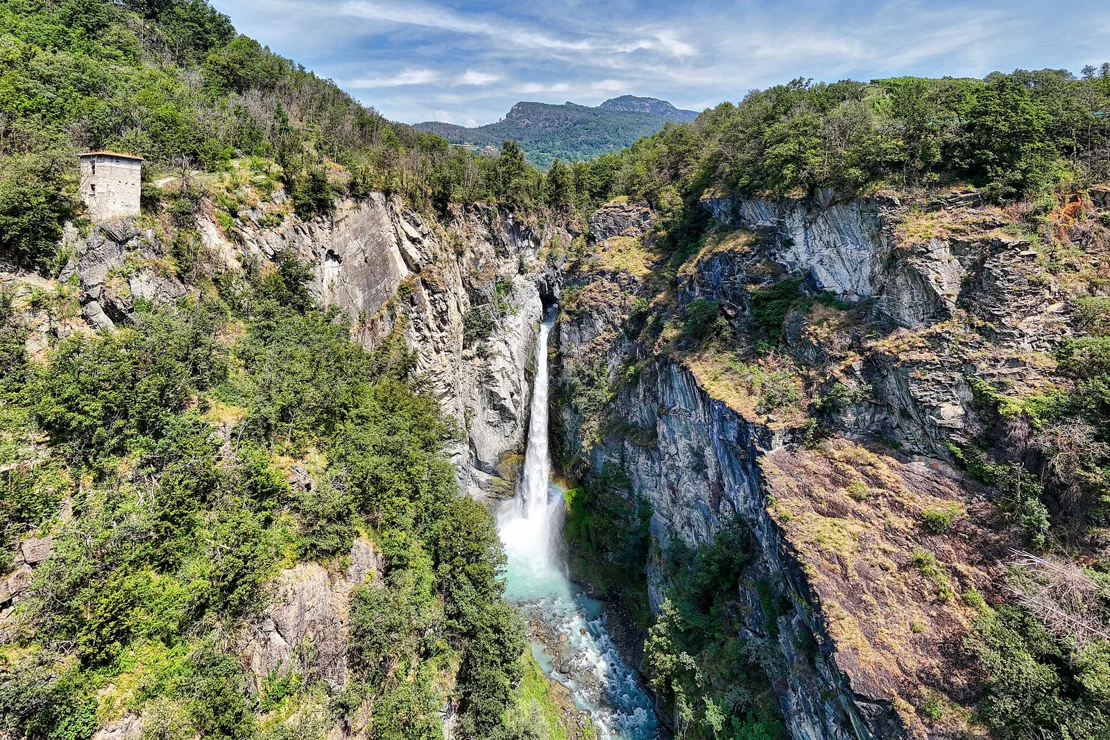
A wild and spectacular loop starting and finishing at Isollaz (700 m) in the municipality of Challand-Saint-Victor. The route plunges into the gorges carved by the Roesaz torrent — one of the most dramatic and least-visited natural environments in the lower Aosta Valley. Narrow metamorphic rock walls close in to form genuine canyons where light barely penetrates, the ground is wet and uneven, and the sound of rushing water is constant. Above the gorges the trail gains height rapidly through forested and then open slopes before descending on the opposite flank. At 9.4 km and 1238 m of ascent, the EE rating reflects exposed passages, boulder stream crossings and faint sections requiring confident navigation. Suitable from June to October in stable conditions.
Aparcamiento
Galería de fotos
Photos are published immediately. JPG/PNG/WebP, max 6 MB.
Flora del sendero
AEditado y verificado por Andrea Rama
Fuente de datos: Catasto Sentieri Regione Autonoma VdA · Open data — DGR 899/2014
Última verificación:
Val d'Ayas
Senderos relacionados
Mismo valle o rutas similares — más excursiones por descubrir.

Val d'Ayas
Amponey - Becca Trecare
A demanding EE ascent from Amponey to Becca Trecare at 3032m — nearly 1500m of gain on varied terrain with sweeping summit views.

Val d'Ayas
Amponey - Alpe Mascognaz
1.8 km · +309 m · E — from Amponey to Alpe Mascognaz (Central Valley).

Val d'Ayas
Amponey - Bec de Nannaz
In the Val d'Ayas, Ayas: an E-rated climb toward a high-altitude objective through pastures and rock with views of Monte Rosa.

Val d'Ayas
Amponey - Mont Facebelle
In the Val d'Ayas, Ayas: an E/EE-rated climb toward a high-altitude objective in the alpine landscape.