High Route 2 — Stage 14: Crest → Donnas
Advertencias
- Check weather and residual snow early season
- Book huts in peak season
18 km
+980 m
−1784 m
7 h
Nivel físico
~1569 kcal estimadas
Mapa y ruta
Traza GPX oficial — Región Valle de Aosta / lovevda.it
Descripción
Puntos clave
Salida
Crest · 317 m
Llegada
Donnas · 1127 m
Final Alta Via 2 stage: climb to Retempio sanctuary, cross Col Pousseuil and descend to Donnas (330 m).
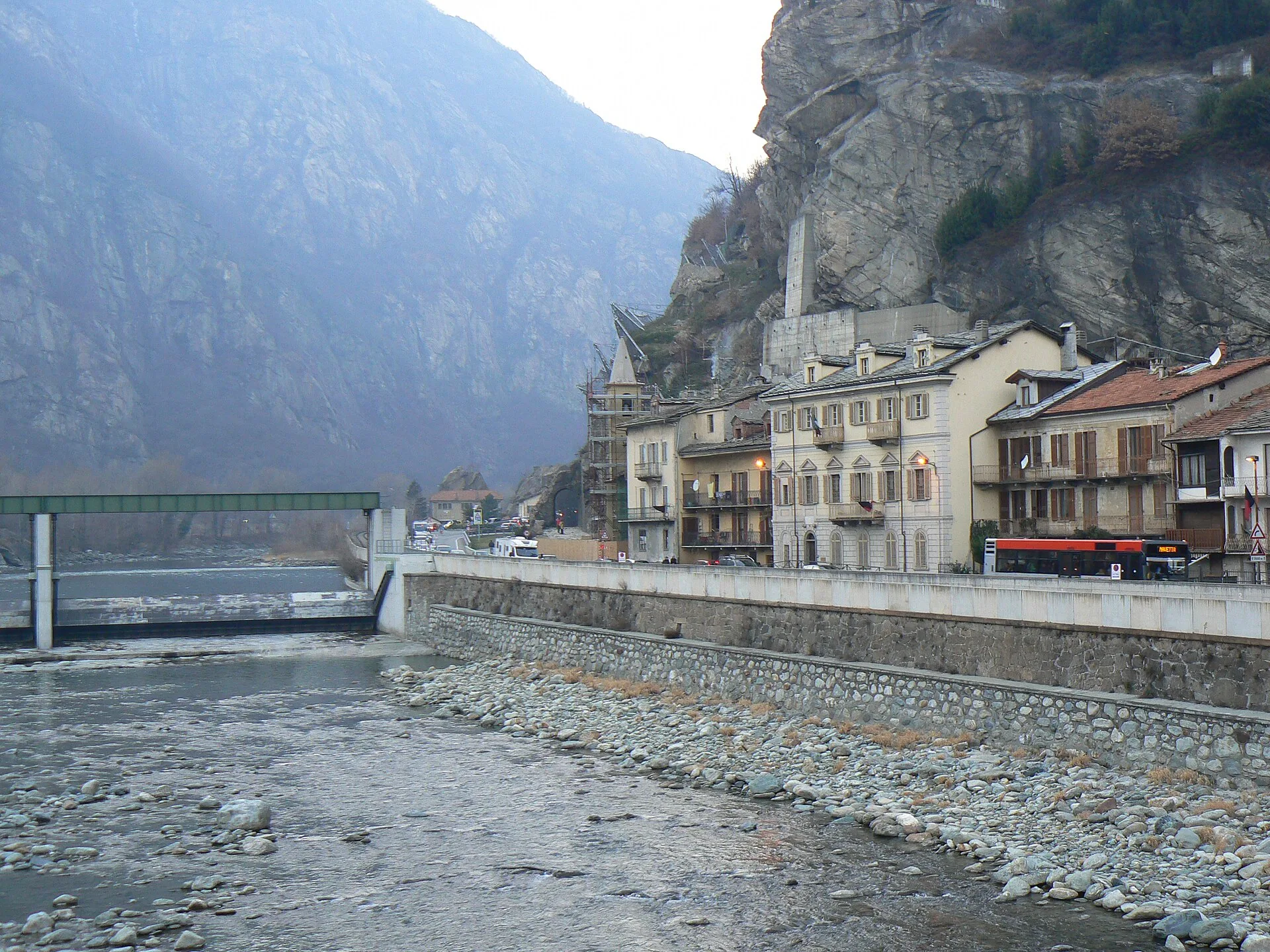
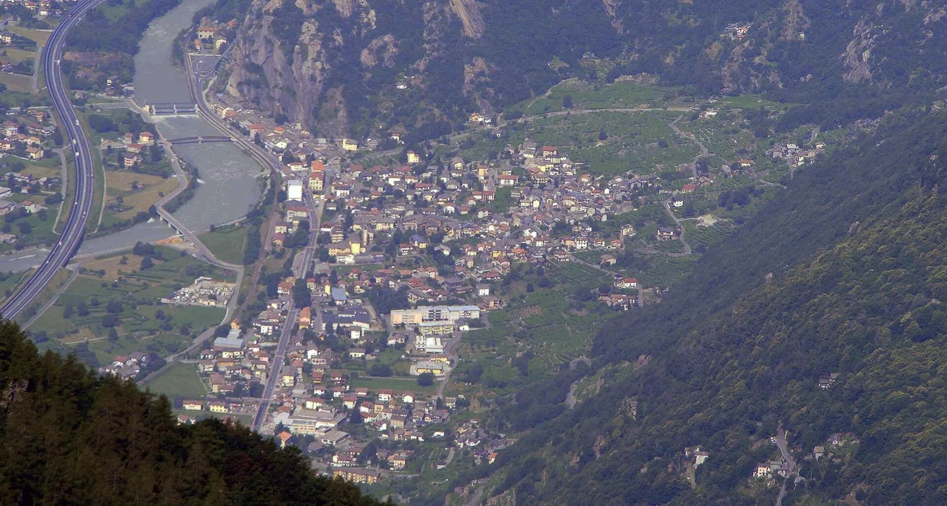
The grand finale descends among heroic vineyards and chestnut woods to the Dora valley floor: you cross the Donnas Nebbiolo terraces, Europe’s highest for this variety, and enter the village along the Roman road of the Gauls, with its rock-cut arch and medieval borgo. Here Alta Via 2 ends, at 322 metres, having touched 3,296 at the Lauson.
Puntos clave
Santuario di Retempio
1460 m · 4 km from start
Col Pousseuil
2100 m · 10 km from start
Marked AV2 alpine pass
Ciencias de la Tierra
Geología y paisaje
Terraced slopes of the lower Dora Baltea: Mesozoic limestones and calcschists, vineyard paleosols and Würmian fluvial terraces.
Historia y cultura
The Roman road at Donnas, cut into the rock in the 1st century BC with its arch and cart ruts still visible, is the best-preserved stretch of the Gallic road.
Fuentes de agua
Fountains and services at Crest-Damon, Donnas and intermediate villages.
Cómo llegar
Trenitalia Donnas station; VITA valley-floor buses.
Aparcamiento
Parcheggi comunali nei paesi di valle; verificare limitazioni in alta stagione.
Galería de fotos
Photos are published immediately. JPG/PNG/WebP, max 6 MB.
Flora del sendero
Etapas contiguas
AEditado y verificado por Andrea Rama
Fuente de datos: Catasto Sentieri Regione Autonoma VdA — Alta Via n.2 · Open data — DGR 899/2014
Última verificación:
Bassa Valle
Senderos relacionados
Mismo valle o rutas similares — más excursiones por descubrir.
Bassa Valle
High Route 1 — Stage 1: Donnas → Perloz
The start of the High Route of the Giants, from the valley floor up to Perloz meadows through Walser villages and chestnut groves.
Bassa Valle — Mont Mars
High Route 1 — Stage 2: Perloz → Rifugio Coda
From Perloz hill the trail climbs through Lillianes forest and into the Mont Mars Nature Reserve, where Rifugio Coda at 2280 m opens the view to the high valley.

Bassa Valle
Arsines - Col Fenetre
A short woodland climb from Arsines, above Arnad, to Col Fenêtre: a scenic pass of the lower Aosta Valley.

Bassa Valle
Bard - Tête de Cou
In the commune of Cogne, Gran Paradiso National Park: a climb toward a high-altitude objective in an environment of exceptional natural quality.