High Route 2 — Stage 3: La Thuile → Promoud
Advertencias
- Check weather and residual snow early season
- Book huts in peak season
 1 / 2
1 / 216 km
+1428 m
−882 m
7 h
Nivel físico
~1745 kcal estimadas
Mapa y ruta
Traza GPX oficial — Región Valle de Aosta / lovevda.it
Descripción
Puntos clave
Salida
La Thuile · 1440 m
Llegada
Promoud · 2485 m
From La Thuile, climb the Rutor valley via La Joux, waterfalls and glacial lakes to Rifugio Deffeyes and Promoud bivouac.
You leave the La Thuile basin up the Rutor valley beside its three waterfalls, then the trail bends towards the Passo Alto (2,857 m), a stern gap among boulder fields where snowfields linger into July. The descent into the Planaval valley, beneath the walls of the Grande Rousse, reaches the tiny village of Promoud, whose gîte d’étape is the only support.
Puntos clave
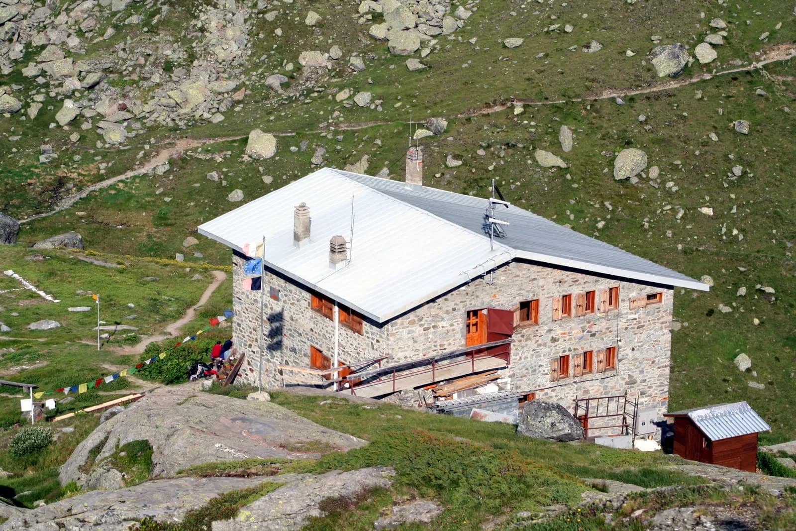
Rifugio Albert Deffeyes
2494 m · 10 km from start
Ciencias de la Tierra
Geología y paisaje
Rutor valley: metamorphic bedrock and active glacial deposits. Retreating Rutor glaciers with proglacial lakes and recent moraines visible from the trail.
Historia y cultura
The Rutor waterfalls fed Italy’s earliest glaciological studies in the 19th century: sudden outbursts of the Santa Margherita glacial lake repeatedly devastated the valley until the basin drained naturally.
Fuentes de agua
Services in La Thuile. Rifugio Deffeyes and Promoud bivouac with water in season.
Cómo llegar
VITA buses and connections from Aosta; check seasonal timetables at vita.it.
Aparcamiento
Parcheggi comunali nei paesi di valle; verificare limitazioni in alta stagione.
Cumbres cercanas
Refugios y vivacs
Galería de fotos
Photos are published immediately. JPG/PNG/WebP, max 6 MB.
Flora del sendero
Etapas contiguas
AEditado y verificado por Andrea Rama
Fuente de datos: Catasto Sentieri Regione Autonoma VdA — Alta Via n.2 · Open data — DGR 899/2014
Última verificación:
La Thuile
Senderos relacionados
Mismo valle o rutas similares — más excursiones por descubrir.
La Thuile — Valgrisenche
Tour du Rutor — Stage 2: Rifugio Albert Deffeyes → Planaval
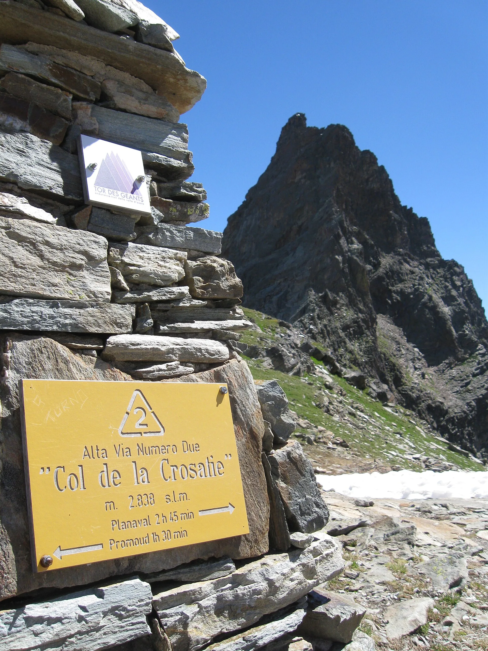
Passo Alto and Col de la Crosatie: the great Alta Via 2 traverse.
La Thuile
Bivio Vallone des Chavannes - Colle del Piccolo San Bernardo
5.2 km · +578 m · E — from Bivio Vallone des Chavannes to Colle del Piccolo San Bernardo (Lys Valley).

La Thuile
Chabodey - Passo Alto (Haut-Pas)
9.9 km · +1873 m · E — from Chabodey to Passo Alto (Haut-Pas) (La Thuile).
La Thuile
Col de la Fouclaz - Mont-Valaisan
4 km · +440 m · E — from Col de la Fouclaz to Mont-Valaisan (Lys Valley).