High Route 1 — Stage 9: Valtournenche → Rifugio Jean Barmasse
Avisos
- Sustained gradient in few kilometres
- Do not combine with stage 10 without excellent fitness
 1 / 3
1 / 34.7 km
+682 m
−25 m
2.5 h
Nível físico
~1800 kcal estimadas
Mapa e percurso
Traço GPX oficial — Região Vale de Aosta / lovevda.it
Descrição
Pontos-chave
Partida
Valtournenche · 1528 m
Chegada
Rifugio Jean Barmasse · 2164 m
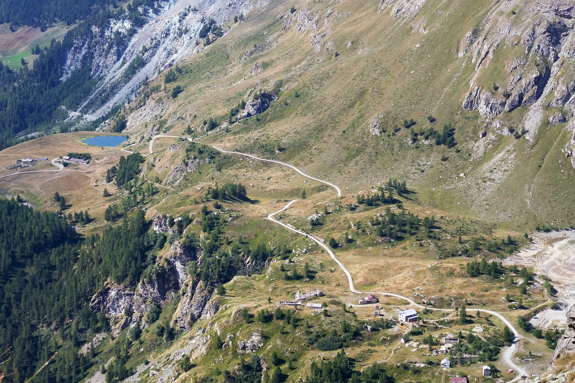
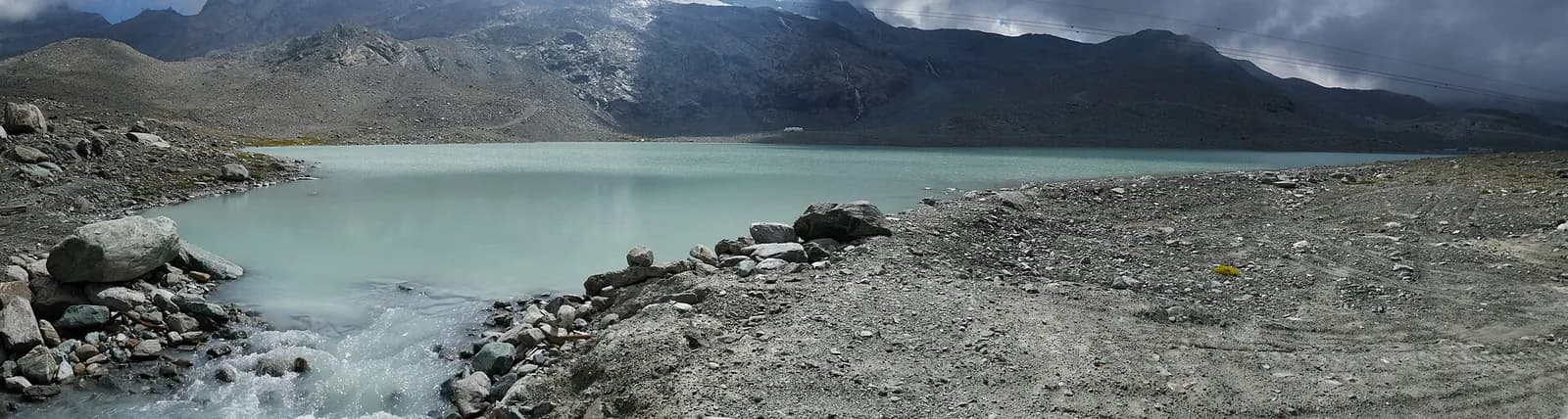
Stage nine is the shortest of the entire Alta Via 1 but no less demanding in gradient: in fewer than five kilometres the trail climbs over 650 metres, rising from the centre of Valtournenche to Rifugio Jean Barmasse on the shore of Lago di Cignana. The stage begins by crossing the Marmore torrent and climbing toward the hamlet of Valmartin, where the path enters a conifer forest and begins a sustained, well-marked ascent. The hydroelectric infrastructure of the dam signals proximity to the artificial lake, a turquoise mirror reflecting the Valtournenche ridgelines. Rifugio Jean Barmasse (2157 m), positioned on the edge of the reservoir, serves as the launchpad for the most demanding stage of the entire Alta Via the following morning. The brevity of this stage is deliberate in the original AV1 design: it allows for genuine rest and energy accumulation before the long traverse toward Rifugio Cuney. Many walkers consider combining stage nine with stage ten, but this is strongly discouraged unless fitness levels are exceptional and an early departure is guaranteed.
Pontos-chave
Valtournenche
1520 m · 0 km from start
Stage start from village centre
Lago di Cignana
2140 m · 4 km from start
Turquoise artificial basin below the dam
Rifugio Jean Barmasse
2157 m · 4.7 km from start
Stage finish, base camp for stage 10
Ciências da Terra
Geologia e paisagem
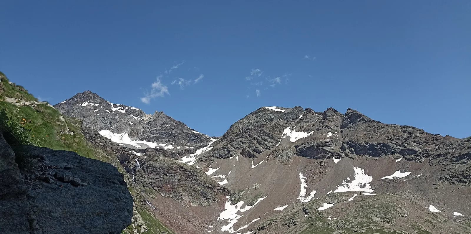
The short climb ascends the western Valtournenche slope on Penninic calcschists and micaschists with serpentinite and metabasalt (ophiolite) outcrops. Lake Cignana occupies a natural basin shaped on Würmian moraines of the Valtournenche glacier, then artificially dammed for hydroelectric production. Rocks around the lake show glacial striations and meltwater potholes. Above the dam, augen gneiss of the Austroalpine basement outcrops with quartz and feldspar bands. Colluvial deposits and historic landslides indicate slope instability below Valmartin. Conifer forests grow on decomposed glacial deposits with acid humus-rich soils.
História e cultura
The Cignana dam is part of the Valdostan hydroelectric network. Barmasse hut is a strategic AV1 stop before the hardest traverse toward Cuney.
Pontos de água
Resupply in Valtournenche. Potable water at Rifugio Barmasse.
Como chegar
VITA bus to Valtournenche. Trail access from the central square.
Estacionamento
Parcheggio a Valtournenche centro, vicino al punto di partenza sentiero.
Cumes próximos
Refúgios e abrigos
Galeria de fotos
Photos are published immediately. JPG/PNG/WebP, max 6 MB.
Flora do trilho
Fauna para observar
Temas e características
Etapas adjacentes
AEditado e verificado por Andrea Rama
Fonte dos dados: Catasto Sentieri Regione VdA + AllTrails (4.7 km, 2h25 verificati) + thealps.com · Open data — DGR 899/2014
Última verificação:
Valtournenche
Trilhos relacionados
Mesmo vale ou percursos semelhantes — mais caminhadas para descobrir.
Valtournenche — Valpelline
Tour of the Matterhorn — Stage 1: Breuil-Cervinia → Rifugio Prarayer
The Valcournera pass, a stern gateway to the Valpelline.
Valtournenche — Val d’Ayas
Tour Monte Rosa — Stage 9: Breuil-Cervinia → Saint-Jacques
The Cime Bianche valley, a natural bridge between the Matterhorn and Monte Rosa.

Valtournenche
Anello Area sportiva-Fiernaz-Area sportiva
2.9 km · +28 m · T — from Area sportiva to Area sportiva (Valtournenche).

Valtournenche
Anello dei Villaggi di Antey ( Ruvère, Liesse,Fontaney, Villettaz)
A loop through the sunlit hamlets of Antey and Torgnon: traditional Aosta Valley architecture, vineyards and mid-mountain forest, 5.2 km from Ruvère.