Trail guide
The best hikes in Cervinia and Valtournenche
The best hikes in Cervinia and Valtournenche: 13 selected trails with difficulty, distance, elevation gain and links to the route pages. Sentieri VdA guide.
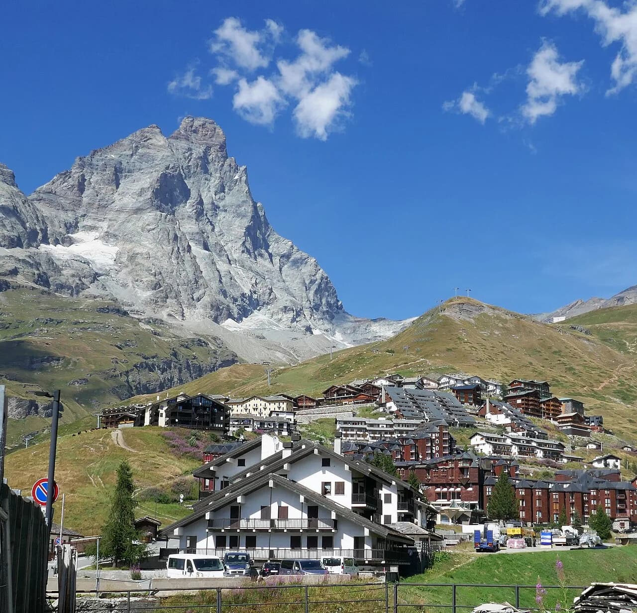
Dominated by the Matterhorn pyramid, Breuil-Cervinia and the Valtournenche offer mirror lakes (Lago Blu, Goillet, Cignana), the Cheneil basin and high-altitude trails among glaciers and alpine pastures.
This guide gathers the best trails in the area, all from the Sentieri VdA catalogue: for each one you get the CAI difficulty, distance, elevation gain and a direct link to the route page with map, elevation profile, photos and the day’s weather.
Every itinerary below uses real data from the Aosta Valley trail registry — waymark numbers, distances and elevation gain — and links to the full page with satellite map, GPX track, elevation profile and the nearest town’s weather. Always check conditions before setting off: at altitude the weather changes fast and some passes stay snow-covered into early summer.
Selected trails
Tour Monte Rosa — Stage 8: Zermatt → Breuil-Cervinia
25.3 km · +2367 m · EEA — from Zermatt to Breuil-Cervinia.
The return to Italy crosses the Theodul pass (3,295 m) over the Theodul glacier: a historic passage since the Middle Ages, today only feasible with a mountain guide and glacier equipment, or comfortably via the Matterhorn Alpine Crossing lifts to Testa Grigia and Breuil-Cervinia (2,006 m).
Tour of the Matterhorn — Stage 8: Zermatt → Breuil-Cervinia
25.3 km · +2367 m · EEA — from Zermatt to Breuil-Cervinia.
The loop closes back at Breuil-Cervinia via the Theodul pass (3,295 m): crossing the Theodul glacier with a mountain guide and equipment, or riding the Matterhorn Alpine Crossing lifts. Marked as a transfer stage, with no hiking track.
Tour of the Matterhorn — Stage 1: Breuil-Cervinia → Rifugio Prarayer
18.2 km · +1418 m · EE — from Breuil-Cervinia to Rifugio Prarayer.
From Breuil-Cervinia climb via the Vofrède valley and the Cignana lakes to the Valcournera pass (3,072 m), a demanding crossing on Alta Via 1. The descent, steep and equipped at first, leads to the Prarayer basin (2,005 m) at the head of the Place Moulin lake.
High Route 1 — Stage 10: Rifugio Jean Barmasse → Rifugio Oratorio di Cuney
17.1 km · +1397 m · EE — from Rifugio Jean Barmasse to Rifugio Oratorio di Cuney.
Stage ten is the wild heart of Alta Via 1: 17 kilometres of high mountain terrain between Valtournenche and Val Saint-Barthélemy, crossing three passes above 2700 metres in a succession of vast, silent landscapes.
Tour Monte Rosa — Stage 9: Breuil-Cervinia → Saint-Jacques
15.6 km · +1004 m · E — from Breuil-Cervinia to Saint-Jacques.
From Breuil-Cervinia climb to the upper Cime Bianche pass (2,982 m), a grand viewpoint over the Matterhorn and the Monte Rosa glaciers, then descend the wild Cime Bianche valley to Saint-Jacques (1,689 m), the last village of the Ayas valley.
High Route 1 — Stage 9: Valtournenche → Rifugio Jean Barmasse
4.7 km · +682 m · E — from Valtournenche to Rifugio Jean Barmasse.
Stage nine is the shortest of the entire Alta Via 1 but no less demanding in gradient: in fewer than five kilometres the trail climbs over 650 metres, rising from the centre of Valtournenche to Rifugio Jean Barmasse on the shore of Lago di Cignana.
High Route 1 — Stage 8: Rifugio Grand Tournalin → Valtournenche
8.7 km · +309 m · E — from Rifugio Grand Tournalin to Valtournenche.
Stage eight is the longest descent in the central sequence of Alta Via 1: from Rifugio Grand Tournalin at 2535 metres the trail drops over a thousand metres to the valley floor of Valtournenche, the main village of the valley that hosts the Breuil-Cervinia ski resort above.
Col Collon - Colle del Teodulo
33.1 km · +2969 m · EE — from Col Collon to Colle del Teodulo.
Col Collon - Colle del Teodulo is an official trail from the Aosta Valley trail registry (code TC_S1). The route lies in the municipality of Bionaz, in the Valpelline. From Col Collon (3077 m) to Colle del Teodulo (3297 m): 33.1 km with +2969 m of elevation change, difficulty EE (CAI scale).
Paquier-Brengaz-Champleve-Barmaz-Cheneil-Becca d'Aran
7.2 km · +1422 m · EE — from Paquier to Becca d'Aran.
Paquier-Brengaz-Champleve-Barmaz-Cheneil-Becca d'Aran is an official trail from the Aosta Valley trail registry (code 71_S25). The route lies in the municipality of Villeneuve, in the Central Valley. From Paquier (1526 m) to Becca d'Aran (2948 m): 7.2 km with +1422 m of elevation change, difficulty EE (CAI scale).
TAPPA 10: Rifugio Barmasse - Rifugio Cuney
16.3 km · +1383 m · EE — from Rifugio Barmasse to Rifugio Cuney.
TAPPA 10: Rifugio Barmasse - Rifugio Cuney is an official trail from the Aosta Valley trail registry (code AV1_S10). The route lies in the municipality of Villeneuve, in the Central Valley. From Rifugio Barmasse (2164 m) to Rifugio Cuney (2653 m): 16.3 km with +1383 m of elevation change, difficulty EE (CAI scale).
Perrères - Col de Valcournera
9 km · +1334 m · EE — from Perrères to Col de Valcournera.
Perrères - Col de Valcournera is an official trail from the Aosta Valley trail registry (code 71_S5). The route lies in the municipality of Villeneuve, in the Central Valley. From Perrères (1738 m) to Col de Valcournera (3072 m): 9 km with +1334 m of elevation change, difficulty EE (CAI scale).
Tourterouse-Losanche-Desert - Colle Superiore delle Cime Bianche Sud
7.2 km · +1316 m · E — from Tourterouse to Colle Superiore delle Cime Bianche Sud.
Tourterouse-Losanche-Desert - Colle Superiore delle Cime Bianche Sud is an official trail from the Aosta Valley trail registry (code 71_S19). The route lies in the municipality of Villeneuve, in the Central Valley.
Cheneil - Mont Roisetta
5 km · +1299 m · EE — from Parcheggio Cheneil to Mont Roisetta.
Cheneil - Mont Roisetta is an official trail from the Aosta Valley trail registry (code 71_S28). The route lies in the municipality of Villeneuve, in the Central Valley. From Parcheggio Cheneil (2023 m) to Mont Roisetta (3322 m): 5 km with +1299 m of elevation change, difficulty EE (CAI scale).
Explore the full catalogue on the Trails page and plan your next hike in the Aosta Valley.