Tour Monte Rosa — Stage 8: Zermatt → Breuil-Cervinia
25.3 km
+2367 m
−1961 m
11.5 h
Fitness level
Map & route
GPX track — verify on the ground before hiking
Description
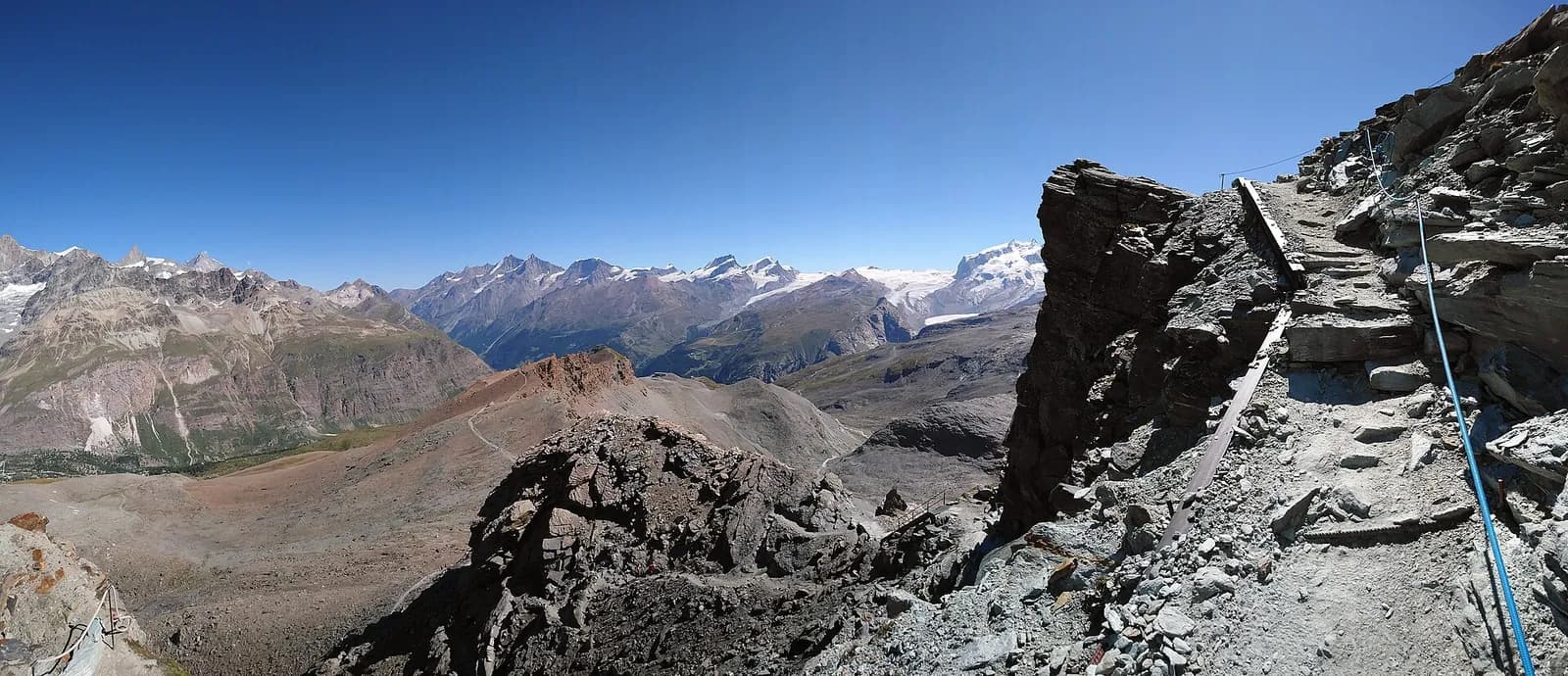
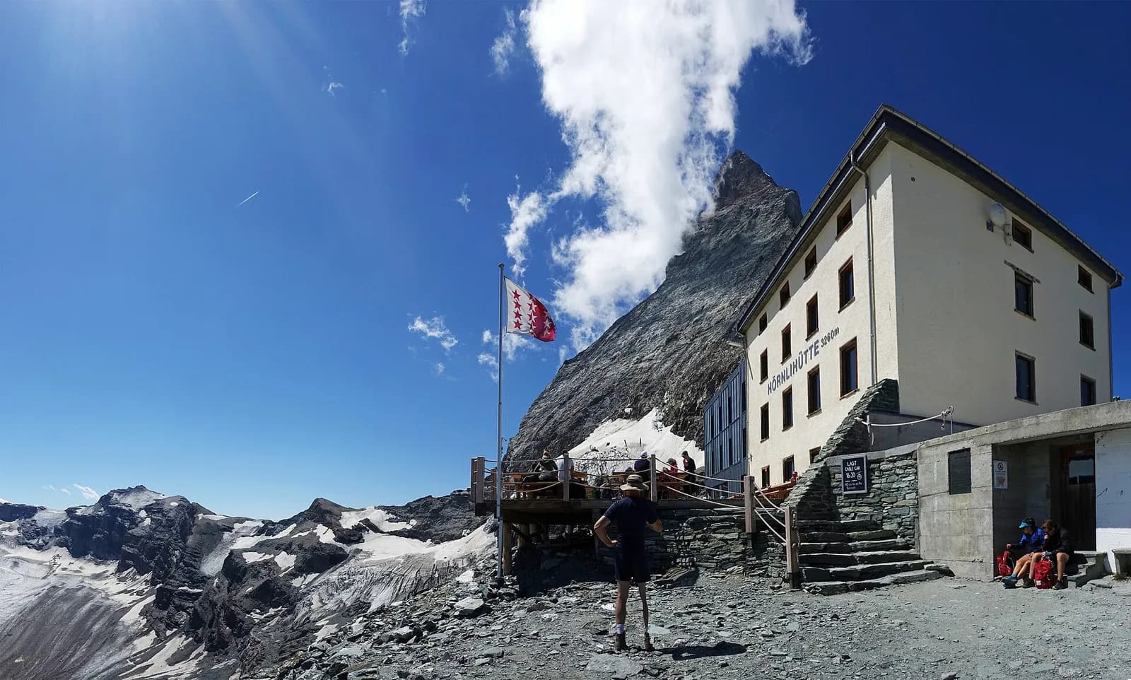
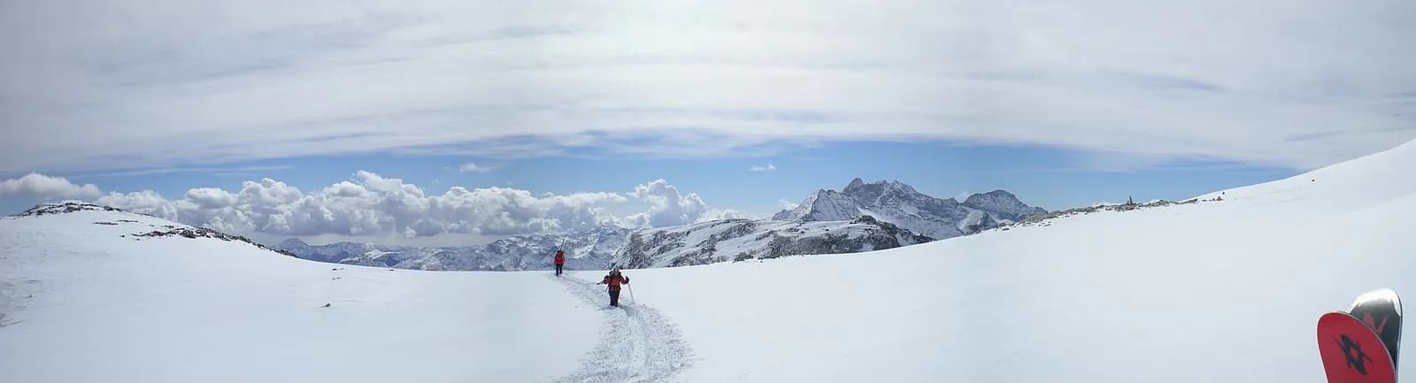
The return to Italy crosses the Theodul pass (3,295 m) over the Theodul glacier: a historic passage since the Middle Ages, today only feasible with a mountain guide and glacier equipment, or comfortably via the Matterhorn Alpine Crossing lifts to Testa Grigia and Breuil-Cervinia (2,006 m). This is therefore marked as a transfer stage, with no hiking track.
The Theodul has always been the natural passage between Valais and the Valtournenche: merchants, pilgrims and even cattle crossed here when the glacier was kinder. Today the summer crossing requires rope, crampons and a guide — the Theodul glacier’s crevasses are unforgiving — or you trust the Matterhorn Alpine Crossing: panoramic cable cars from Zermatt to Testa Grigia and Cervinia via the Klein Matterhorn, Europe’s highest cable link. At the pass, the Theodul refuge and the old customs ruins recall that the border ran — and runs — right here.
Key points
Theodulpass
3295 m · 10.3 km from start
Earth sciences
Geology & landscape
Monte Rosa is the core of the Penninic nappe of the same name: gneisses and granites of subducted, exhumed European continental crust. Around it the tour crosses the Zermatt-Saas ophiolite zone — green serpentinites, metabasalts and metagabbros, the floor of a vanished Jurassic ocean — outcropping at the Olen, Theodul and Cime Bianche passes. The 2,600-metre Macugnaga east face is the highest wall in the Alps and exposes the nappe in full section.
History & culture
Glacial retreat on the Theodul has yielded Roman coins and the belongings of a 17th-century merchant: proof of trade crossing this ice uninterrupted for two thousand years.
Water sources
Water at the stage's support points (Zermatt, Breuil-Cervinia). On the high ground and at the passes springs are not guaranteed: fill bottles in the valley and at the huts.
Getting there
Cross-border stage: on the foreign sides local public transport applies (PostAuto in Switzerland, line buses in France/Piedmont). Check seasonal timetables; in peak season several access links run by reservation only.
Warnings
- Glacier crossing: only with a mountain guide and equipment, or use the lifts
Start & end
Start
Zermatt
1608 m
Finish
Breuil-Cervinia
2006 m
Adjacent stages
ACurated and verified by Andrea
Data source: Tour del Monte Rosa — itinerario internazionale segnalato (TMR) · Traccia calcolata su rete sentieri OpenStreetMap (ODbL); verificare sul terreno
Last verified:
Mattertal — Valtournenche
Related trails
Same valley or similar routes — more hikes to explore.
Mattertal — Valtournenche
Tour of the Matterhorn — Stage 8: Zermatt → Breuil-Cervinia
The Theodul pass closes the loop: glacier with a guide, or cable car.
Valle del Lys
Tour Monte Rosa — Stage 1: Gressoney-Saint-Jean → Lago Gabiet
From the Walser capital to Lake Gabiet.
Val d’Ayas — Valle del Lys
Tour Monte Rosa — Stage 10: Saint-Jacques → Gressoney-Saint-Jean
The Pinter pass closes the Aosta Valley loop of the Rosa.
Valle del Lys — Valsesia (Piemonte)
Tour Monte Rosa — Stage 2: Lago Gabiet → Alagna Valsesia
The Col d’Olen and the descent into Valsesia, beyond the Aosta Valley.