Trail guide
The best hikes in Cogne
The best hikes in Cogne: 13 selected trails with difficulty, distance, elevation gain and links to the route pages. Sentieri VdA guide.
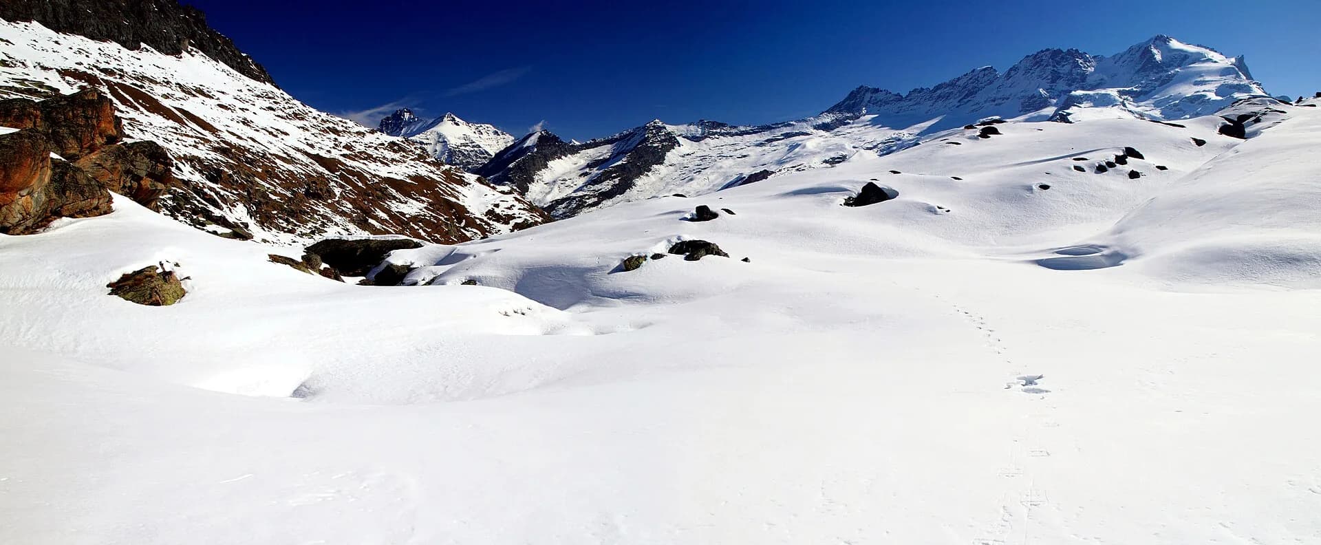
The Aosta Valley heart of the Gran Paradiso National Park, Cogne is a hiking capital: the Valnontey with the Paradisia garden, the Sant’Orso meadows, the Lussert lakes and panoramic balconies facing glaciers and ibex.
This guide gathers the best trails in the area, all from the Sentieri VdA catalogue: for each one you get the CAI difficulty, distance, elevation gain and a direct link to the route page with map, elevation profile, photos and the day’s weather.
Every itinerary below uses real data from the Aosta Valley trail registry — waymark numbers, distances and elevation gain — and links to the full page with satellite map, GPX track, elevation profile and the nearest town’s weather. Always check conditions before setting off: at altitude the weather changes fast and some passes stay snow-covered into early summer.
Selected trails
Gran Paradiso Tour — Stage 8: Eaux Rousses → Rifugio Vittorio Sella
16.7 km · +1755 m · EE — from Eaux Rousses to Rifugio Vittorio Sella.
The loop returns towards Cogne re-crossing the Col Lauson (3,296 m) from the Levionaz side: 1,600 metres of steady climbing on the royal mule track, often in the company of ibex, to regain the pass and descend to Rifugio Vittorio Sella (2,588 m).
High Route 2 — Stage 10: Cogne → Rifugio Sogno di Berdzé
12 km · +1100 m · E — from Cogne to Rifugio Sogno di Berdzé.
Climb Val di Cogne via Lillaz and Urtier pastures to Sogno di Berdzé hut. From Cogne you ascend the wild Urtier valley, the most secluded on this side: working alps, stone bridges and, high on the opposite flank, the abandoned Colonna mines.
Gran Paradiso Tour — Stage 2: Valnontey → Rifugio Vittorio Sella
5.7 km · +922 m · E — from Valnontey to Rifugio Vittorio Sella.
From Valnontey climb the historic hunting mule track of King Vittorio Emanuele II, in regular bends through woods and pastures, to Rifugio Vittorio Sella al Lauson (2,588 m). Ibex grazing at dusk are almost guaranteed here.
Lake Djouan from Valnontey
11 km · +850 m · E — from Valnontey to Valnontey.
From the Eaux-Rousses car park in Valsavarenche, the royal mule track climbs at a steady grade through larch forest to the Orvieille alp, where Vittorio Emanuele II’s court halted during the royal hunts: the avenue of trees and the lodge are still there.
Gran Paradiso Tour — Stage 3: Rifugio Vittorio Sella → Eaux Rousses
16.7 km · +827 m · EE — from Rifugio Vittorio Sella to Eaux Rousses.
From the Sella hut climb to the Col Lauson (3,296 m), the tour’s highest point and one of the highest hiking passes in the Alps, with a steep final stretch on scree. A long descent through the Levionaz valley, among chamois and marmots, reaches Eaux-Rousses (1,666 m) in Valsavarenche.
High Route 2 — Stage 11: Rifugio Sogno di Berdzé → Rifugio Dondena
7 km · +301 m · E — from Rifugio Sogno di Berdzé to Rifugio Dondena.
Climb to Fenêtre de Champorcher, skirt Lake Misérin and Rifugio Misérin before descending to Dondena in Mont Avic Regional Park. The Fenêtre de Champorcher (2,827 m) is the Alta Via’s last great pass: from the col, on clear days, Monte Rosa fills the north-eastern horizon.
Epinel - Bivacco Gratton
6.9 km · +1772 m · E — from Epinel to Bivacco Gratton.
Epinel - Bivacco Gratton is an official trail from the Aosta Valley trail registry (code 21_S57). The route lies in the municipality of Donnas, in the Lys Valley. From Epinel (1430 m) to Bivacco Gratton (3195 m): 6.9 km with +1772 m of elevation change, difficulty E (CAI scale).
Cretaz - Bivacco Gratton
6.4 km · +1712 m · E — from Cretaz to Bivacco Gratton.
Cretaz - Bivacco Gratton is an official trail from the Aosta Valley trail registry (code 21_S103). The route lies in the municipality of Donnas, in the Lys Valley. From Cretaz (1483 m) to Bivacco Gratton (3195 m): 6.4 km with +1712 m of elevation change, difficulty E (CAI scale).
Champlong - Colonna - Mont Creyaz
5.4 km · +1405 m · E — from Champlong to Mont Creyaz.
Champlong - Colonna - Mont Creyaz is an official trail from the Aosta Valley trail registry (code 21_S16). The route lies in the municipality of Donnas, in the Lys Valley. From Champlong (1621 m) to Mont Creyaz (3023 m): 5.4 km with +1405 m of elevation change, difficulty E (CAI scale).
Lillaz - Santuario di San Besso
12.3 km · +1392 m · E — from Lillaz to Santuario di San Besso.
Lillaz - Santuario di San Besso is an official trail from the Aosta Valley trail registry (code PDS_S3). The route lies in the municipality of Donnas, in the Lys Valley. From Lillaz (1612 m) to Santuario di San Besso (2925 m): 12.3 km with +1392 m of elevation change, difficulty E (CAI scale).
Gimillan - Col de Saint-Marcel
8.4 km · +1198 m · E — from Gimillan to Col de Saint-Marcel.
Gimillan - Col de Saint-Marcel is an official trail from the Aosta Valley trail registry (code 21_S10). The route lies in the municipality of Donnas, in the Lys Valley. From Gimillan (1804 m) to Col de Saint-Marcel (2922 m): 8.4 km with +1198 m of elevation change, difficulty E (CAI scale).
Antiche miniere di ferro di Colonna
3.8 km · +852 m · E — from Moline to Miniere di Colonna.
Antiche miniere di ferro di Colonna is an official trail from the Aosta Valley trail registry (code 21_S106). The route lies in the municipality of Donnas, in the Lys Valley. From Moline (1569 m) to Miniere di Colonna (2425 m): 3.8 km with +852 m of elevation change, difficulty E (CAI scale).
Alpe Bardoney (incrocio sentieri 12-13G)- Col de l'Arolla
5.3 km · +684 m · EE — from Alpe Bardoney (incrocio sentieri 12-13G) to Col de l'Arolla.
Alpe Bardoney (incrocio sentieri 12-13G)- Col de l'Arolla is an official trail from the Aosta Valley trail registry (code 21_S31). The route lies in the municipality of Donnas, in the Lys Valley.
Explore the full catalogue on the Trails page and plan your next hike in the Aosta Valley.