Trail guide
The best hikes in Courmayeur
The best hikes in Courmayeur: 13 selected trails with difficulty, distance, elevation gain and links to the route pages. Sentieri VdA guide.
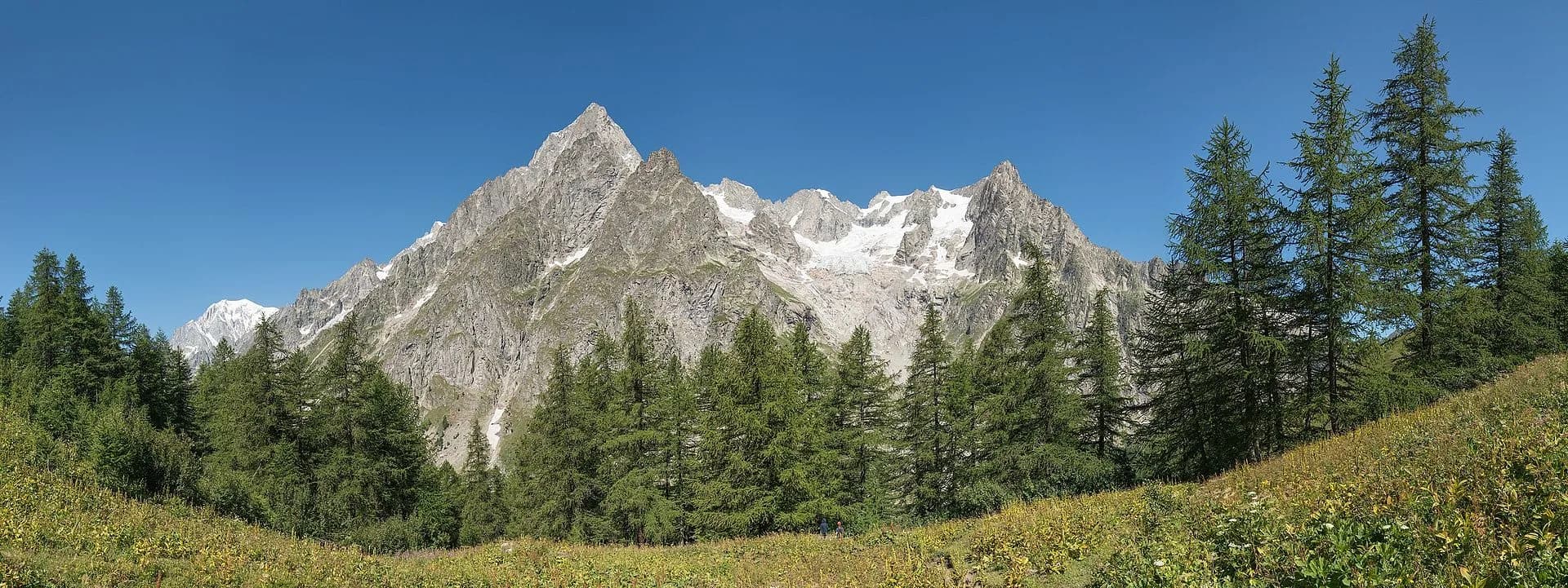
At the foot of Mont Blanc, Courmayeur offers the Alps’ most spectacular balconies: Val Ferret and Val Veny, the Bonatti and Bertone refuges, the Tour du Mont Blanc and head-on views of the Grandes Jorasses and Dent du Géant.
This guide gathers the best trails in the area, all from the Sentieri VdA catalogue: for each one you get the CAI difficulty, distance, elevation gain and a direct link to the route page with map, elevation profile, photos and the day’s weather.
Every itinerary below uses real data from the Aosta Valley trail registry — waymark numbers, distances and elevation gain — and links to the full page with satellite map, GPX track, elevation profile and the nearest town’s weather. Always check conditions before setting off: at altitude the weather changes fast and some passes stay snow-covered into early summer.
Selected trails
High Route 2 — Stage 1: Courmayeur → Rifugio Elisabetta Soldini
15 km · +1406 m · E — from Courmayeur to Rifugio Elisabetta Soldini.
Start in Courmayeur, cross Dolonne and climb to Rifugio Maison Vieille before reaching Lac Combal plateau and Rifugio Elisabetta Soldini. Classic stage with Grandes Jorasses views.
Tour du Mont Blanc — Stage 12: Les Chapieux → Rifugio Elisabetta Soldini
14 km · +1083 m · E — from Les Chapieux to Rifugio Elisabetta Soldini.
From Les Chapieux ascend the Vallée des Glaciers past the Mottets hut to the Col de la Seigne (2,516 m), the TMB’s Italian gateway: ahead opens Val Veny with the Pyramides Calcaires and the Aiguille Noire. A short descent leads to Rifugio Elisabetta Soldini (2,195 m).
Tour du Mont Blanc — Stage 1: Courmayeur → Rifugio Giorgio Bertone
4.7 km · +767 m · E — from Courmayeur to Rifugio Giorgio Bertone.
From the centre of Courmayeur (1,224 m) the TMB trail climbs steadily through the Villair woods to Rifugio Bertone (1,989 m), overlooking Mont Chétif and the Mont Blanc chain. A short but steep stage, ideal for finding your trekking rhythm.
Tour du Mont Blanc — Stage 2: Rifugio Giorgio Bertone → Rifugio Walter Bonatti
9.9 km · +739 m · E — from Rifugio Giorgio Bertone to Rifugio Walter Bonatti.
From Rifugio Bertone the trail runs high along the Mont de la Saxe flank, with the Planpincieux glacier and the Grandes Jorasses in sight the whole way to Rifugio Bonatti (2,025 m). One of the most scenic half-stages of the entire TMB.
Rifugio Bonatti loop
13.2 km · +650 m · E — from Lavachey to Lavachey.
The loop starts at Lavachey in the heart of Val Ferret and climbs to Arnouva before gaining the balcony of Rifugio Bonatti, one of the most photographed terraces in the Alps: opposite, in a row, the Dent du Géant, the Grandes Jorasses and the Planpincieux glacier.
Tour du Mont Blanc — Stage 4: Rifugio Elena → La Fouly
9.7 km · +503 m · E — from Rifugio Elena to La Fouly.
From Rifugio Elena a steady climb leads to the Grand Col Ferret (2,537 m), the Italian-Swiss border and the watershed between the Mediterranean and the North Sea. A long grassy descent through the Swiss Val Ferret, past the La Peule alp, ends in the village of La Fouly (1,610 m).
Tour du Mont Blanc — Stage 13: Rifugio Elisabetta Soldini → Courmayeur
15.9 km · +461 m · E — from Rifugio Elisabetta Soldini to Courmayeur.
From Rifugio Elisabetta cross the Lac Combal plain, dammed by the Miage glacier moraine, then climb onto the Arp Vieille–Mont Favre balcony with the whole south side of Mont Blanc on parade. Via the Col Chécrouit and Maison Vieille you finally descend to Courmayeur, where the loop closes.
High Route 1 — Stage 16: Rifugio Frassati → Rifugio Bonatti via Col Malatrà
10 km · +430 m · EE — from Rifugio Pier Giorgio Frassati to Rifugio Walter Bonatti.
Stage sixteen is the most alpine stretch of the entire Alta Via 1: it climbs to Col Malatrà at 2925 metres — the highest point of the whole route — and descends into Val Ferret to Rifugio Walter Bonatti.
Tour du Mont Blanc — Stage 3: Rifugio Walter Bonatti → Rifugio Elena
7.2 km · +373 m · E — from Rifugio Walter Bonatti to Rifugio Elena.
From Rifugio Bonatti you drop to Arnouva and climb the head of Val Ferret to Rifugio Elena (2,062 m), facing the snout of the Pré de Bar glacier and Mont Dolent, the mountain of three borders.
Col de la Seigne - Col Grand Ferret
40.4 km · +2547 m · E — from Col de la Seigne to Col Grand Ferret.
Col de la Seigne - Col Grand Ferret is an official trail from the Aosta Valley trail registry (code TMB_S1). The route lies in the municipality of Doues, in the Great St Bernard Valley. From Col de la Seigne (2514 m) to Col Grand Ferret (2525 m): 40.4 km with +2547 m of elevation change, difficulty E (CAI scale).
Colle Grand Saint Bernard - Col Grand Ferret
26.3 km · +2016 m · E — from Colle Grand Saint Bernard to Col Grand Ferret.
Colle Grand Saint Bernard - Col Grand Ferret is an official trail from the Aosta Valley trail registry (code TSB_S1). The route lies in the municipality of Sarre, in the Central Valley. From Colle Grand Saint Bernard (2449 m) to Col Grand Ferret (2525 m): 26.3 km with +2016 m of elevation change, difficulty E (CAI scale).
TAPPA 01: Courmayeur - Rifugio Elisabetta
15.2 km · +1482 m · E — from Capoluogo to Rifugio Elisabetta.
TAPPA 01: Courmayeur - Rifugio Elisabetta is an official trail from the Aosta Valley trail registry (code AV2_S1). The route lies in the municipality of Doues, in the Great St Bernard Valley. From Capoluogo (1200 m) to Rifugio Elisabetta (2152 m): 15.2 km with +1482 m of elevation change, difficulty E (CAI scale).
Hermitage - Tirecorne - Verrand (Pré Saint-Didier)
7.4 km · +1321 m · E — from Hermitage to Verrand.
Hermitage - Tirecorne - Verrand (Pré Saint-Didier) is an official trail from the Aosta Valley trail registry (code 22_S39). The route lies in the municipality of Doues, in the Great St Bernard Valley. From Hermitage (1479 m) to Verrand (1970 m): 7.4 km with +1321 m of elevation change, difficulty E (CAI scale).
Explore the full catalogue on the Trails page and plan your next hike in the Aosta Valley.