
E
Bassa Valle
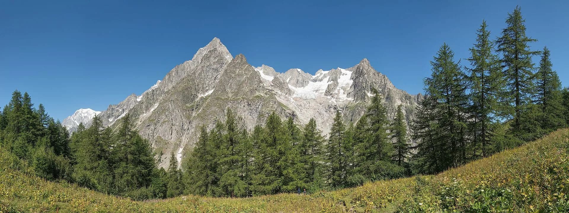
High Route 1 — Stage 1: Donnas → Perloz
The start of the High Route of the Giants, from the valley floor up to Perloz meadows through Walser villages and chestnut groves.
12.5 km+950 m5 h
Where to spot
16 trails where Golden eagle is listed in flora/fauna: difficulty E–EE, elevation gain 180–1397 m.
16 · 4.7–18.2 km · +180–1397 m
Bassa Valle
The start of the High Route of the Giants, from the valley floor up to Perloz meadows through Walser villages and chestnut groves.

Valtournenche — Val Saint-Barthélemy
The wild heart of the Alta Via: 17 km across Fenêtre de Tsan, Col Terray and on to Rifugio Oratorio di Cuney, with Matterhorn and Grand Combin dominating a horizon of 2700-metre passes.

Valpelline
From the Sanctuary of Cuney to the Valpelline: a long descent over exposed ridges with short scramble sections, ending at Oyace in the heart of the Aosta Valley's most untouched valley.

Valpelline
The wild Valpelline: Oyace and Ollomont sit at nearly the same elevation, but Col Brison at 2520 m demands over 1100 m of climbing with views to Mont Vélan and Grand Combin on the Swiss border.

Valpelline — Conca di By
From Ollomont to Rifugio Champillon in the Conca di By: 1000 m of climbing through forests and summer farms to one of the AV1's most distinctive huts, complete with mountain sauna and yurt.

Valle del Gran San Bernardo
Over Col Champillon (2709 m) with panoramic views from Mont Blanc to Gran Paradiso, followed by a long descent to Saint-Rhémy-en-Bosses in the historic upper Grand Saint-Bernard valley.

Valle del Gran San Bernardo
A steady climb through the Merdeux basin to Rifugio Frassati at 2540 m, the last overnight stop before tackling Col Malatrà (2925 m), the highest pass on the entire Alta Via 1.
Val Ferret
Col Malatrà at 2925 m is the rooftop of Alta Via 1: from the panoramic crest above Mont Blanc the trail descends into Val Ferret to the legendary Rifugio Walter Bonatti.

Val Ferret
The final AV1 stage: the Val Ferret balcony trail with Mont Blanc and Grandes Jorasses always in sight, ending at Courmayeur, Italy's alpine capital.

Bassa Valle — Mont Mars
From Perloz hill the trail climbs through Lillianes forest and into the Mont Mars Nature Reserve, where Rifugio Coda at 2280 m opens the view to the high valley.

Mont Mars — Valle di Gaby
A high-level traverse between Mont Mars and the Barma Lakes: a skyline path linking two historic huts across a landscape of peat bogs, glacial slabs and end-of-summer bilberry.

Valle di Gaby
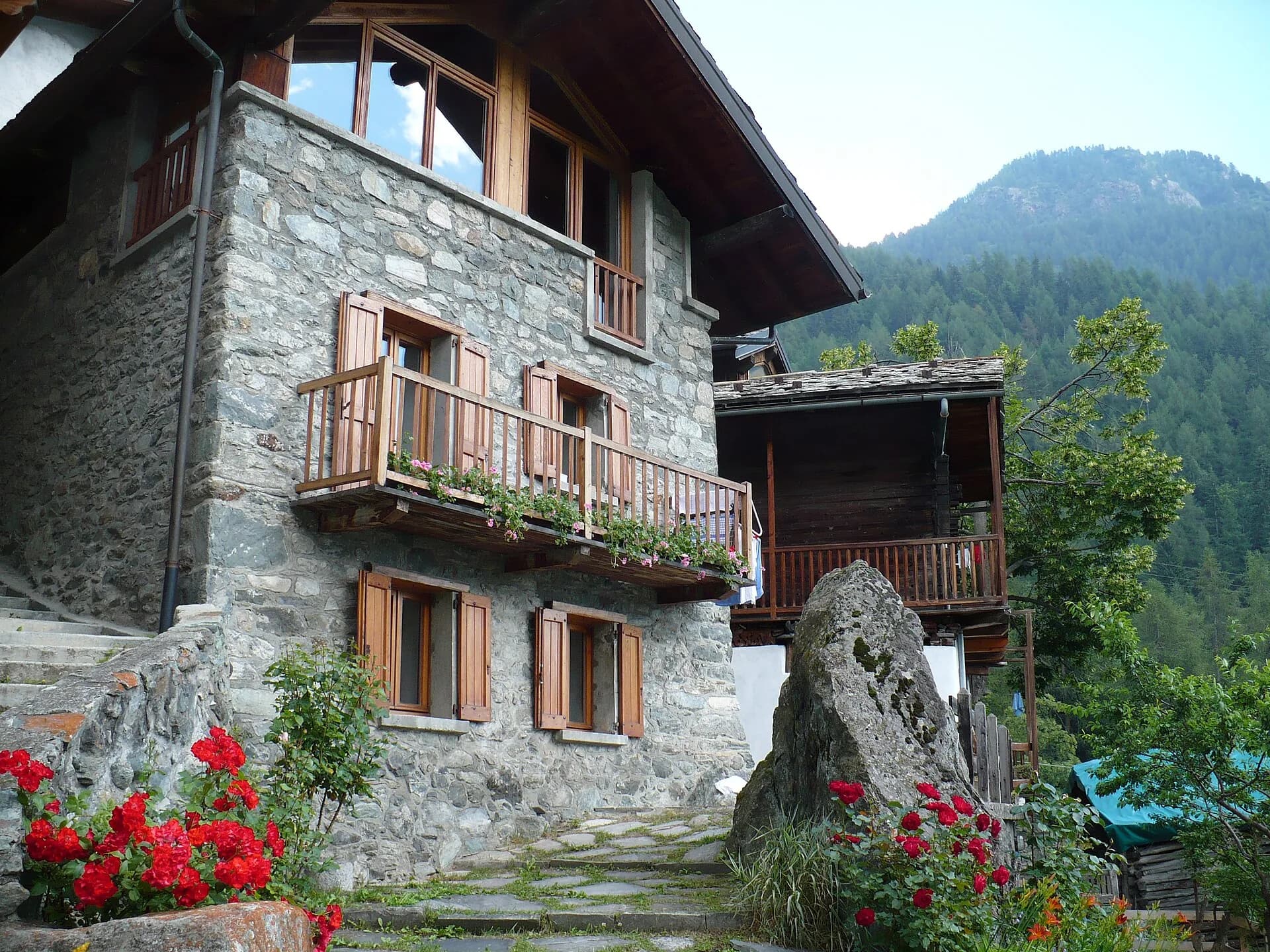
From Barma Hut the trail descends to Niel, Gaby's most remote Walser hamlet: a village frozen in time where dark-stone houses preserve centuries of alpine culture.

Valle di Gressoney
The longest stage in this sequence: 18 km of solitary ridge walking above the Lys valley with Monte Rosa views, ending in the Walser town of Gressoney-Saint-Jean.
Valtournenche
The great descent: from Rifugio Grand Tournalin losing over a thousand metres to the valley floor of Valtournenche, passing through the scenic plateau of Cheneil with Matterhorn views.

Valtournenche
The shortest stage on the entire AV1: 4.7 km of sustained climbing from Valtournenche to Rifugio Jean Barmasse on the shores of Lago di Cignana, in preparation for the hardest day ahead.

Val di Cogne
From the heart of Gran Paradiso National Park to an alpine lake surrounded by ibex. A classic.